Map shows exact path helicopter took over East River


UPPER EAST SIDE, Manhattan (WABC) -- A flight radar map map shows the path a helicopter took before it crashed into the East River on Sunday night.
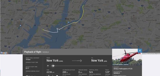
The flight began in Kearny, New Jersey before stopping by the Statue of Liberty, flying up the East River and over the Brooklyn Bridge, before it crashed into the East River near 90th Street.
The flight path shows the flight ending near 40th Street, but it is possible they lost contact before it went down into the East River.
Pictures posted on Twitter possibly show the helicopter moments before it crashed into the East River.

Credit: @EricAdams321/Twitter
Eric Adams says he was in the air with 'FlyNYON' at the same time the helicopter crashed into the East River.
Adams says he took the photos what he believes to be a few moments before the incident and on the ground prior to takeoff.
----------


