24/7 Live
New York City
New Jersey
Long Island
Northern Suburbs
Connecticut
7-Day Forecast
Live
The Loop
Keep WABC on the Air
Cyclosporiasis outbreak
Living with Alzheimer's
More News
Famous Deaths
Submit News Tips
TV Listings
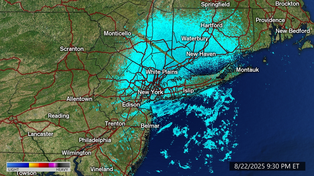
AccuTrack Radar
Share
Tweet
Email
AccuTrack Radar
Share
Tweet
Email
Animate
Boroughs
Long Island
New Jersey
Futurecast
Current Airport Delays
Rainfall Today
Show More
Severe Weather Risk Today
Severe Risk Tomorrow
Almanac
Current Temperatures
Today's High Temperatures
Today's Low Temperatures
Wind Gusts
Peak Wind Gusts
Wind Chill Temperatures
Air Quality, UV Index, Pollen Forecast
7-Day Forecast
AccuTrack Radar
Show Fewer
Weather Team
Lee Goldberg
Sam Champion
Jeff Smith
Brittany Bell
Dani Beckstrom