ABC7 New York 24/7 Eyewitness News Stream
Watch Now
THE LOOP | NYC Weather and Traffic Cams
Watch Now
WATCH
LIVE
New York City
New Jersey
Long Island
Northern Suburbs
Connecticut
EDIT
Log In
Watch
Apps
Local News
New York City
New Jersey
Long Island
Northern Suburbs
Connecticut
Categories
Mornings @ 10
Extra Time
Neighborhood Safety Tracker
Shop
Localish
7 On Your Side
7 On Your Side Investigates
Health
Weather
Traffic
US World
Politics
Entertainment
Sports
Vault
Station Info
About ABC 7
Meet the News Team
ABC 7 In Your Community
Sweepstakes and Rules
TV Listings
Jobs
shows
Live with Kelly and Mark
Here and Now
Tiempo
Up Close with Bill Ritter
ABC 7 Shows & Specials
Equity Report
Follow Us:
Welcome,
Manage MyDisney Account
Log Out
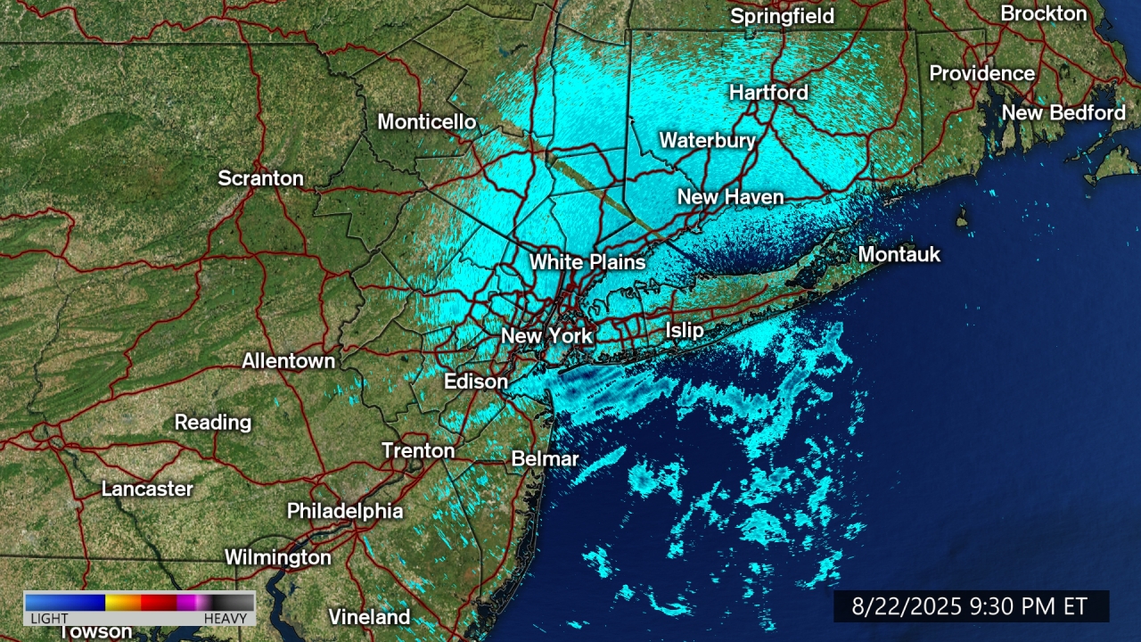
AccuTrack Radar
Share
Tweet
Email
AccuTrack Radar
Share
Tweet
Email
Animate
Boroughs
Long Island
New Jersey
Futurecast
Current Airport Delays
Rainfall Today
Show More
Severe Weather Risk Today
Severe Risk Tomorrow
Almanac
Current Temperatures
Today's High Temperatures
Today's Low Temperatures
Wind Gusts
Peak Wind Gusts
Wind Chill Temperatures
Air Quality, UV Index, Pollen Forecast
7-Day Forecast
AccuTrack Radar
Show Fewer
Weather Team
Lee Goldberg
Sam Champion
Jeff Smith
Brittany Bell
Dani Beckstrom