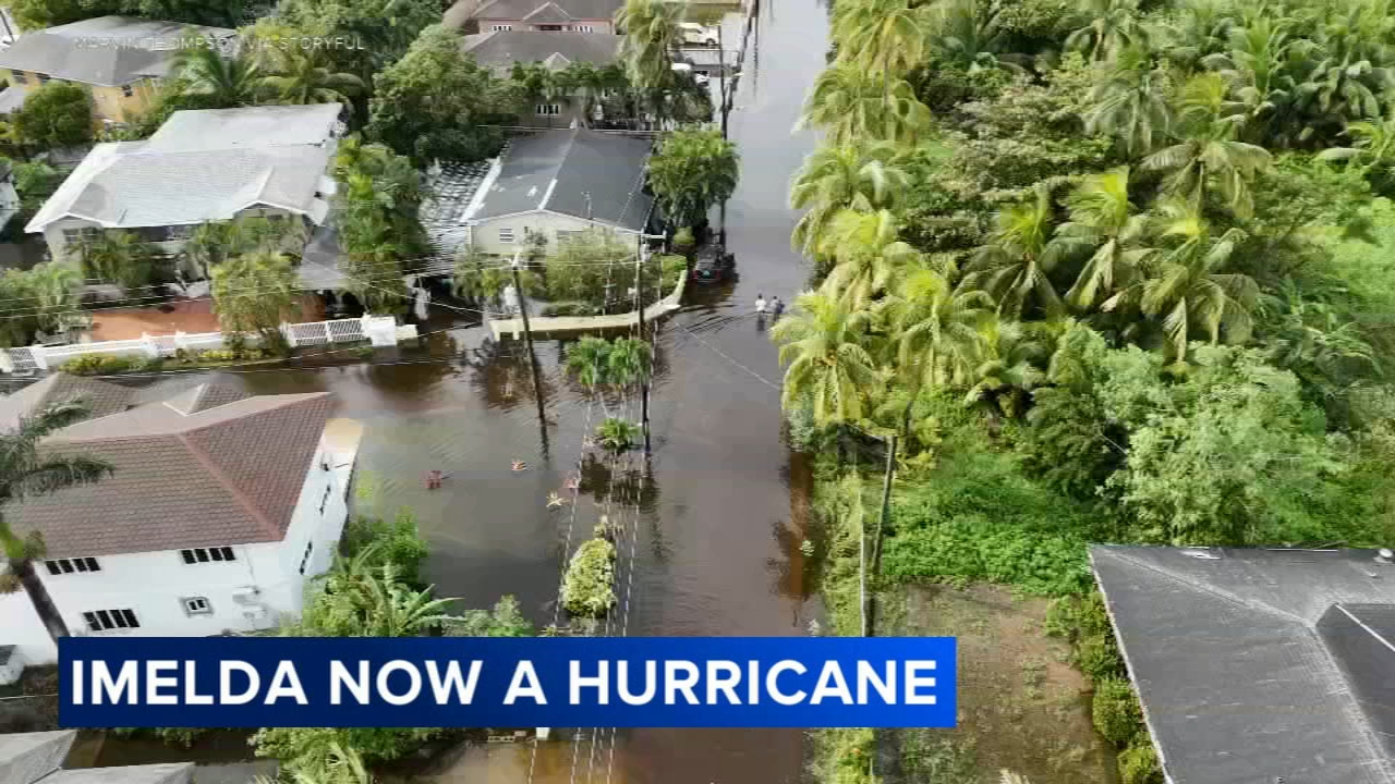
Imelda strengthens into a hurricane as US coast feels impacts, Bermuda prepares for twin storms
Bermuda faces a rare one-two punch from Hurricane Humberto and Imelda this week.

Hurricanes Imelda and Humberto are spinning in the western Atlantic and churning up dangerous surf, rip currents, coastal flooding and beach erosion along the United States' East Coast.
Bermuda - now under a hurricane warning - faces a rare one-two punch from the storms, as Humberto brushes by the archipelago Tuesday followed by a direct hit from Imelda.
As of Tuesday afternoon, Imelda was a Category 1 hurricane with sustained winds of 85 mph and was centered just over 300 miles east of Cape Canaveral, Florida, and more than 600 miles west-southwest of Bermuda, according to the National Hurricane Center.
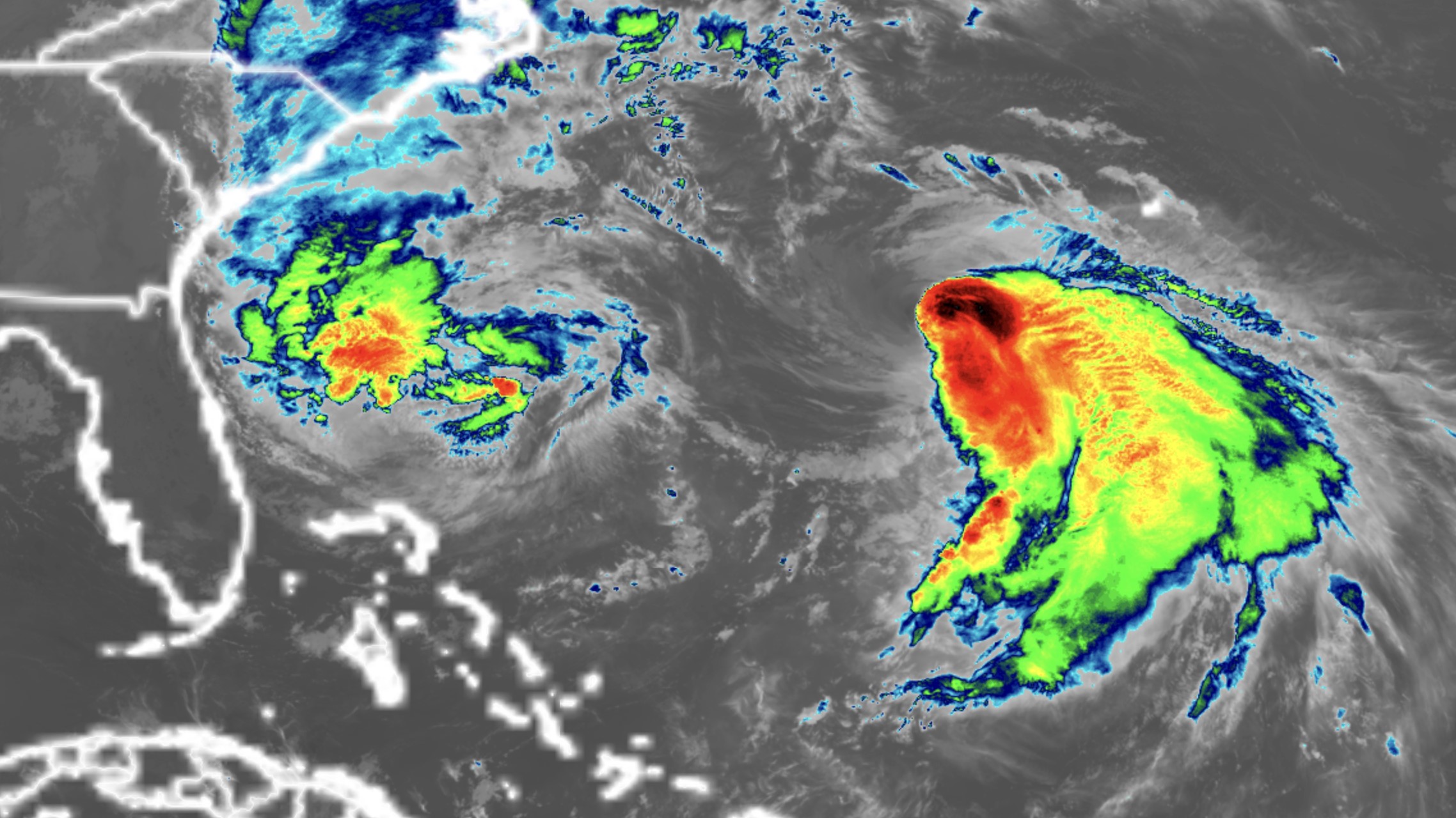
Humberto, which briefly exploded into a rare Category 5 storm with 160 mph winds Saturday, continued to deteriorate Tuesday into a Category 1 hurricane a few hundred miles northeast of Imelda. Humberto's massive size will compound the hazards for US beaches this week by driving dangerous rip currents and big waves farther north along the East Coast than Imelda would alone.
Imelda and Humberto were unusually close early Tuesday, around 450 miles apart, one of the 10-closest pairs of named Atlantic storms since the use of satellites began in 1966, according to hurricane expert Michael Lowry.
RELATED: Here's what can happen when two hurricanes get too close together
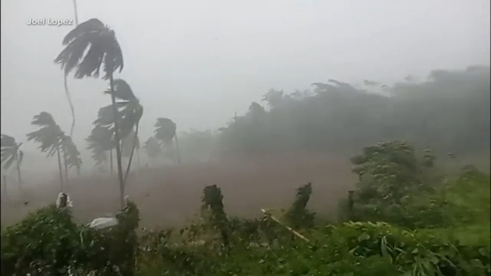
Imelda pulled away from the Bahamas Monday evening after lashing the islands with heavy rain, tropical storm-force winds and storm surge for two days.
Despite its center staying offshore, Imelda has already proven deadly. A 51-year-old man drowned in Volusia County, Florida, after being swept into the ocean by rip currents, the sheriff's office said. In Cuba, the storm left two dead, Prime Minister Manuel Marrero said. One of those killed was a 60-year-old man who died when his home collapsed in a landslide caused by heavy rain, according to the Associated Press.
Localized flash flooding is still possible in the coastal Carolinas through Tuesday. Most places across the region can expect up to 2 inches of rain, with localized areas receiving up to 4 inches across southeast North Carolina.
Coastal flooding is also possible from Florida's Space Coast to North Carolina's Outer Banks, where onshore winds could push water 1 to 2 feet above normally dry ground at high tide.
Imelda took a sharp right turn as Humberto yanked the storm eastward away from the shoreline early Tuesday. The interaction between the two storms is the main reason threats of flooding rain and damaging winds have decreased for the US compared to over the weekend.
The US has avoided a hurricane landfall so far this year. Tropical Storm Chantal came ashore in South Carolina this July, but no storms have reached the coast at hurricane strength in 2025. If this streak holds, it would be the first season without a landfalling hurricane in a decade.
This season has been remarkable in another way: Its first three hurricanes - Erin, Gabrielle and Humberto - all reached major strength, a feat not seen since 1935. Major hurricanes are Category 3, 4 and 5 storms. Rapid intensification has become far more common in recent years as the planet warms due to fossil fuel pollution.
Imelda is expected to top out as Category 2, so it will be the first hurricane of this season to stay below major strength.
Bermuda faces a rare one-two punch

Bermuda is a sitting duck in the path of twin storms that could deliver a punishing blow this week, even for the seasoned and storm-tested islands.
Humberto is passing west of the island as a large hurricane Tuesday, bringing bands of rain, gusty winds and dangerous surf.
Imelda is expected to track much closer to Bermuda than Humberto, with the potential for a direct landfall, sustained winds of more than 74 mph and higher gusts, and up to 4 inches of rain Wednesday into Thursday.
(The-CNN-Wire & 2025 Cable News Network, Inc., a Time Warner Company. All rights reserved.)