AccuWeather: Lingering AM rain
AccuWeather forecast for NYC, New York, New Jersey and Connecticut


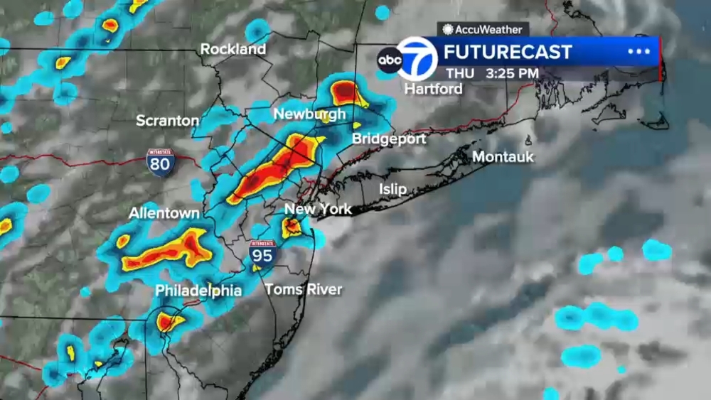
NEW YORK (WABC) -- The major flooding threat is over for most of the Tri-State on Thursday evening; however there could still be some downpours and standing water for early commuters Friday.
Showers will die out overnight and Friday morning will begin with some fog. Then the clouds will break and with the front still limping through, there can still be a couple of showers or thundershowers near I-95 and east.
It will be humid for most of the day Friday but then will drop Saturday morning and temperatures start out the day in the 60s and 50s for some areas west.
It will be pleasant for the last weekend of August.

THE 7-DAY FORECAST
Friday
Lingering T-storm S&E. High 82
Saturday
Less humid, sun/clouds. High 80
Sunday
Partly sunny. Dry for most. High 83
Monday
Humid, PM shower. High 84
Tuesday
Stays humid, PM storm. High 86
Wednesday
Most active day. High 82
Thursday
Drying out. High 80

Follow the Weather or Not podcast with Lee Goldberg
Please fill out the form below to submit weather photos and videos.
MORE ACCUWEATHER RESOURCES
Check AccuTrack Radar
Air Quality Tracker
NWS Advisories, Watches and Warnings
School closings and delays
For weather updates wherever you go, please download the AccuWeather app.
Follow chief meteorologist Lee Goldberg, Sam Champion, meteorologist Brittany Bell, meteorologist Jeff Smith, and meteorologist Dani Beckstrom on social media.