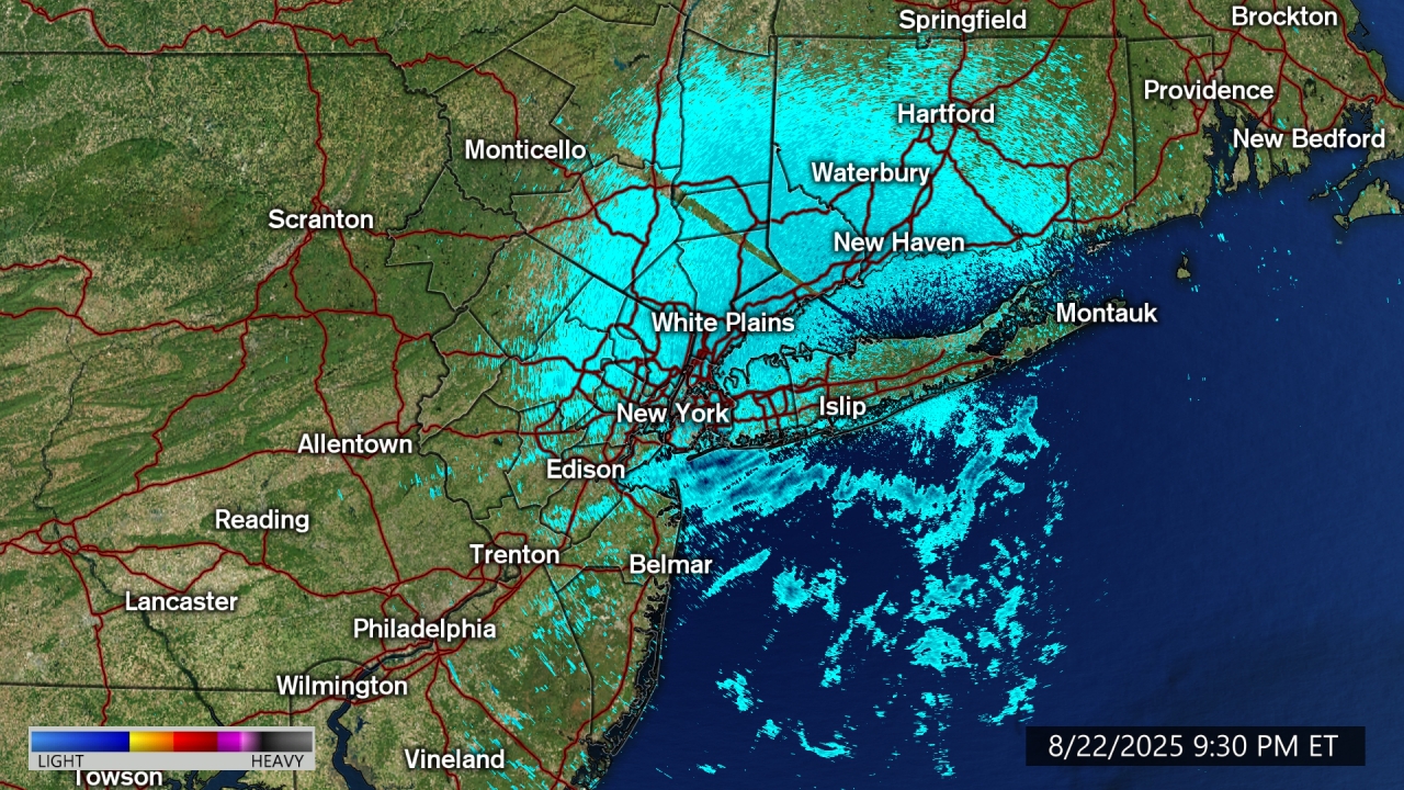
AccuTrack Radar

- Flood Watch
* WHAT...Flash flooding caused by excessive rainfall continues to be possible. * WHERE...Portions of central New York, including the following areas, Broome, Chenango, Delaware, Otsego and Sullivan and northeast Pennsylvania, including the following areas, Lackawanna, Luzerne, Northern Wayne, Pike, Southern Wayne, Susquehanna and Wyoming. * WHEN...Through Wednesday evening. * IMPACTS...Excessive runoff may result in flooding of rivers, creeks, streams, and other low-lying and flood-prone locations. Creeks and streams may rise out of their banks. Flooding may occur in poor drainage and urban areas. * ADDITIONAL DETAILS... - Multiple rounds of showers and storms are expected to move over the area starting this morning through Wednesday. Rainfall rates could exceed 1-2 inches per hour with the heaviest downpours. Even though this area has been somewhat dry recently, multiple rounds of heavy downpours could cause urban flash flooding and/or small streams and creeks to flow out of their banks. Two day rainfall totals are expected to be in the 2-3 inch range, with 3-6 inches possible in portions of the Catskills if upslope enhancement matches up with storms producing heavy downpours. - http://www.weather.gov/safety/floodMore
- Flood Watch
* WHAT...Flash flooding caused by excessive rainfall continues to be possible. * WHERE...Portions of northeast New Jersey, including the following areas, Eastern Bergen, Eastern Essex, Eastern Passaic, Eastern Union, Hudson, Western Essex and Western Union and southeast New York, including the following areas, Bronx, Kings (Brooklyn), New York (Manhattan), Northern Queens, Richmond (Staten Island), Southern Queens and Southern Westchester. * WHEN...From 8 AM EDT this morning through Wednesday evening. * IMPACTS...Excessive runoff may result in flooding of rivers, creeks, streams, and other low-lying and flood-prone locations. * ADDITIONAL DETAILS... - A slow moving low pressure system will bring multiple rounds of heavy showers and thunderstorms to the area today through Wednesday. Average rainfall amounts are expected to be between 2 and 3 inches with localized higher amounts. Peak hourly rainfall rates could be as high as 1.5 to 2.5 inches in the heaviest showers and thunderstorms. - http://www.weather.gov/safety/floodMore
- Flood Watch
* WHAT...Flooding caused by excessive rainfall continues to be possible. * WHERE...Portions of northeast New Jersey, including the following areas, Western Bergen and Western Passaic and southeast New York, including the following areas, Northern Westchester, Orange, Putnam and Rockland. * WHEN...From 8 AM EDT this morning through Wednesday evening. * IMPACTS...Excessive runoff may result in flooding of rivers, creeks, streams, and other low-lying and flood-prone locations. * ADDITIONAL DETAILS... - A slow moving low pressure system will bring multiple rounds of heavy showers and thunderstorms to the area today through Wednesday. Average rainfall amounts are expected to be between 3 and 5 inches with localized higher amounts. Peak hourly rainfall rates could be as high as 2 to 3 inches in the heaviest showers and thunderstorms. - http://www.weather.gov/safety/floodMore
- Flood Watch
* WHAT...Flooding caused by excessive rainfall continues to be possible. * WHERE...Portions of southern Connecticut, including the following areas, Northern Middlesex and Southern Middlesex and southeast New York, including the following areas, Northern Nassau, Northwest Suffolk, Southern Nassau and Southwest Suffolk. * WHEN...From 2 PM EDT this afternoon through Wednesday evening. * IMPACTS...Excessive runoff may result in flooding of rivers, creeks, streams, and other low-lying and flood-prone locations. * ADDITIONAL DETAILS... - A slow moving low pressure system will bring multiple rounds of heavy showers and thunderstorms to the area today through Wednesday. Average rainfall amounts are expected to be between 2 and 3 inches with localized higher amounts. Peak hourly rainfall rates could be as high as 1.5 to 2.5 inches in the heaviest showers and thunderstorms. - http://www.weather.gov/safety/floodMore
- Flood Watch
* WHAT...Flooding caused by excessive rainfall continues to be possible. * WHERE...The mid-Hudson Valley, eastern Catskills, and the central and southern Taconics in eastern New York, Litchfield County in northwest Connecticut, and Berkshire County in western Massachusetts. * WHEN...From 2 PM EDT this afternoon through Wednesday evening. * IMPACTS...Excessive runoff from heavy rainfall rates may flood low-lying, poor drainage, urban, and other flood-prone locations. Areas where heavy rainfall rates persist will especially be vulnerable to flash flooding. * ADDITIONAL DETAILS... - Periods of moderate to heavy rain and thunderstorms capable of heavy downpours arrive this afternoon from west to east and continue tonight with rainfall rates reaching or exceeding 1 to 2 inches per hour at times. Despite recent dry conditions, such high rainfall rates in a short period of time can result in flash flooding, especially in urban and poor drainage areas and where heavy rain repeatedly impacts a given area. Steady rain continues into Wednesday before transitioning to showers Wednesday night into Thursday. Three day rainfall totals likely range from 1 to 3 inches with isolated amounts of 3 to 7 inches across portions of the eastern Catskills, Litchfield County and central and southern Taconics due to upslope enhancements. - http://www.weather.gov/safety/floodMore
- Flood Watch
* WHAT...Flash flooding caused by excessive rainfall continues to be possible. * WHERE...Portions of northeast New Jersey, including the following areas, Eastern Bergen, Eastern Essex, Eastern Passaic, Eastern Union, Hudson, Western Essex and Western Union and southeast New York, including the following areas, Bronx, Kings (Brooklyn), New York (Manhattan), Northern Queens, Richmond (Staten Island), Southern Queens and Southern Westchester. * WHEN...From 8 AM EDT this morning through Wednesday evening. * IMPACTS...Excessive runoff may result in flooding of rivers, creeks, streams, and other low-lying and flood-prone locations. * ADDITIONAL DETAILS... - A slow moving low pressure system will bring multiple rounds of heavy showers and thunderstorms to the area today through Wednesday. Average rainfall amounts are expected to be between 2 and 3 inches with localized higher amounts. Peak hourly rainfall rates could be as high as 1.5 to 2.5 inches in the heaviest showers and thunderstorms. - http://www.weather.gov/safety/floodMore
- Flood Watch
* WHAT...Flooding caused by excessive rainfall continues to be possible. * WHERE...Portions of northeast New Jersey, including the following areas, Western Bergen and Western Passaic and southeast New York, including the following areas, Northern Westchester, Orange, Putnam and Rockland. * WHEN...From 8 AM EDT this morning through Wednesday evening. * IMPACTS...Excessive runoff may result in flooding of rivers, creeks, streams, and other low-lying and flood-prone locations. * ADDITIONAL DETAILS... - A slow moving low pressure system will bring multiple rounds of heavy showers and thunderstorms to the area today through Wednesday. Average rainfall amounts are expected to be between 3 and 5 inches with localized higher amounts. Peak hourly rainfall rates could be as high as 2 to 3 inches in the heaviest showers and thunderstorms. - http://www.weather.gov/safety/floodMore
- Flood Watch
* WHAT...Flash flooding caused by excessive rainfall continues to be possible. * WHERE...Portions of northern Delaware, including the following area, New Castle, New Jersey, including the following areas, Camden, Coastal Ocean, Eastern Monmouth, Gloucester, Mercer, Northwestern Burlington, Ocean, Salem, Southeastern Burlington and Western Monmouth, and Pennsylvania, including the following areas, Berks, Delaware, Eastern Chester, Eastern Montgomery, Lower Bucks, Philadelphia, Upper Bucks, Western Chester and Western Montgomery. * WHEN...From 8 AM EDT this morning through Wednesday afternoon. * IMPACTS...Excessive runoff may result in flooding of rivers, creeks, streams, and other low-lying and flood-prone locations. Creeks and streams may rise out of their banks. Flooding may occur in poor drainage and urban areas. * ADDITIONAL DETAILS... - Widespread showers and thunderstorms will move through today into tonight. Rainfall rates of 1 to 3 inches per hour are possible. Rainfall amount of 1 to 3 inches are expected with locally higher amounts possible. - http://www.weather.gov/safety/floodMore
- Flood Watch
* WHAT...Flash flooding caused by excessive rainfall continues to be possible. * WHERE...Portions of New Jersey, including the following counties, Hunterdon, Middlesex, Morris, Somerset, Sussex and Warren and Pennsylvania, including the following counties, Carbon, Lehigh, Monroe and Northampton. * WHEN...From 8 AM EDT this morning through Wednesday evening. * IMPACTS...Excessive runoff may result in flooding of rivers, creeks, streams, and other low-lying and flood-prone locations. * ADDITIONAL DETAILS... - Widespread showers and thunderstorms will move through today into tonight. Rainfall rates of 1 to 3 inches per hour are possible. Another round of heavy rain is anticipated on Wednesday afternoon and evening. This could further result in flash flooding and/or flooding of creeks and streams. Rainfall amount of 2 to 5 inches are expected with locally higher amounts possible. - http://www.weather.gov/safety/floodMore
- Flood Watch
* WHAT...Flooding caused by excessive rainfall continues to be possible. * WHERE...A portion of southern Connecticut, including the following areas, Northern Fairfield, Northern New Haven, Southern Fairfield and Southern New Haven. * WHEN...From 2 PM EDT this afternoon through Wednesday evening. * IMPACTS...Excessive runoff may result in flooding of rivers, creeks, streams, and other low-lying and flood-prone locations. * ADDITIONAL DETAILS... - A slow moving low pressure system will bring multiple rounds of heavy showers and thunderstorms to the area today through Wednesday. Average rainfall amounts are expected to be between 3 and 5 inches with localized higher amounts. Peak hourly rainfall rates could be as high as 2 to 3 inches in the heaviest showers and thunderstorms. - http://www.weather.gov/safety/floodMore
- Flood Watch
* WHAT...Flooding caused by excessive rainfall continues to be possible. * WHERE...Portions of southern Connecticut, including the following areas, Northern Middlesex and Southern Middlesex and southeast New York, including the following areas, Northern Nassau, Northwest Suffolk, Southern Nassau and Southwest Suffolk. * WHEN...From 2 PM EDT this afternoon through Wednesday evening. * IMPACTS...Excessive runoff may result in flooding of rivers, creeks, streams, and other low-lying and flood-prone locations. * ADDITIONAL DETAILS... - A slow moving low pressure system will bring multiple rounds of heavy showers and thunderstorms to the area today through Wednesday. Average rainfall amounts are expected to be between 2 and 3 inches with localized higher amounts. Peak hourly rainfall rates could be as high as 1.5 to 2.5 inches in the heaviest showers and thunderstorms. - http://www.weather.gov/safety/floodMore
- Flood Watch
* WHAT...Flooding caused by excessive rainfall continues to be possible. * WHERE...The mid-Hudson Valley, eastern Catskills, and the central and southern Taconics in eastern New York, Litchfield County in northwest Connecticut, and Berkshire County in western Massachusetts. * WHEN...From 2 PM EDT this afternoon through Wednesday evening. * IMPACTS...Excessive runoff from heavy rainfall rates may flood low-lying, poor drainage, urban, and other flood-prone locations. Areas where heavy rainfall rates persist will especially be vulnerable to flash flooding. * ADDITIONAL DETAILS... - Periods of moderate to heavy rain and thunderstorms capable of heavy downpours arrive this afternoon from west to east and continue tonight with rainfall rates reaching or exceeding 1 to 2 inches per hour at times. Despite recent dry conditions, such high rainfall rates in a short period of time can result in flash flooding, especially in urban and poor drainage areas and where heavy rain repeatedly impacts a given area. Steady rain continues into Wednesday before transitioning to showers Wednesday night into Thursday. Three day rainfall totals likely range from 1 to 3 inches with isolated amounts of 3 to 7 inches across portions of the eastern Catskills, Litchfield County and central and southern Taconics due to upslope enhancements. - http://www.weather.gov/safety/floodMore
- Flood Watch
* WHAT...Flash flooding caused by excessive rainfall continues to be possible. * WHERE...Portions of central New York, including the following areas, Broome, Chenango, Delaware, Otsego and Sullivan and northeast Pennsylvania, including the following areas, Lackawanna, Luzerne, Northern Wayne, Pike, Southern Wayne, Susquehanna and Wyoming. * WHEN...Through Wednesday evening. * IMPACTS...Excessive runoff may result in flooding of rivers, creeks, streams, and other low-lying and flood-prone locations. Creeks and streams may rise out of their banks. Flooding may occur in poor drainage and urban areas. * ADDITIONAL DETAILS... - Multiple rounds of showers and storms are expected to move over the area starting this morning through Wednesday. Rainfall rates could exceed 1-2 inches per hour with the heaviest downpours. Even though this area has been somewhat dry recently, multiple rounds of heavy downpours could cause urban flash flooding and/or small streams and creeks to flow out of their banks. Two day rainfall totals are expected to be in the 2-3 inch range, with 3-6 inches possible in portions of the Catskills if upslope enhancement matches up with storms producing heavy downpours. - http://www.weather.gov/safety/floodMore
- Flood Watch
* WHAT...Flash flooding caused by excessive rainfall continues to be possible. * WHERE...Portions of northern Delaware, including the following area, New Castle, New Jersey, including the following areas, Camden, Coastal Ocean, Eastern Monmouth, Gloucester, Mercer, Northwestern Burlington, Ocean, Salem, Southeastern Burlington and Western Monmouth, and Pennsylvania, including the following areas, Berks, Delaware, Eastern Chester, Eastern Montgomery, Lower Bucks, Philadelphia, Upper Bucks, Western Chester and Western Montgomery. * WHEN...From 8 AM EDT this morning through Wednesday afternoon. * IMPACTS...Excessive runoff may result in flooding of rivers, creeks, streams, and other low-lying and flood-prone locations. Creeks and streams may rise out of their banks. Flooding may occur in poor drainage and urban areas. * ADDITIONAL DETAILS... - Widespread showers and thunderstorms will move through today into tonight. Rainfall rates of 1 to 3 inches per hour are possible. Rainfall amount of 1 to 3 inches are expected with locally higher amounts possible. - http://www.weather.gov/safety/floodMore
- Flood Watch
* WHAT...Flash flooding caused by excessive rainfall continues to be possible. * WHERE...Portions of New Jersey, including the following counties, Hunterdon, Middlesex, Morris, Somerset, Sussex and Warren and Pennsylvania, including the following counties, Carbon, Lehigh, Monroe and Northampton. * WHEN...From 8 AM EDT this morning through Wednesday evening. * IMPACTS...Excessive runoff may result in flooding of rivers, creeks, streams, and other low-lying and flood-prone locations. * ADDITIONAL DETAILS... - Widespread showers and thunderstorms will move through today into tonight. Rainfall rates of 1 to 3 inches per hour are possible. Another round of heavy rain is anticipated on Wednesday afternoon and evening. This could further result in flash flooding and/or flooding of creeks and streams. Rainfall amount of 2 to 5 inches are expected with locally higher amounts possible. - http://www.weather.gov/safety/floodMore