AccuWeather Alert: Flash flood warning for NYC, parts of the Tri-State
AccuWeather forecast for NYC, New York, New Jersey and Connecticut


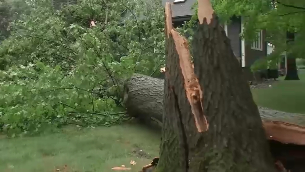
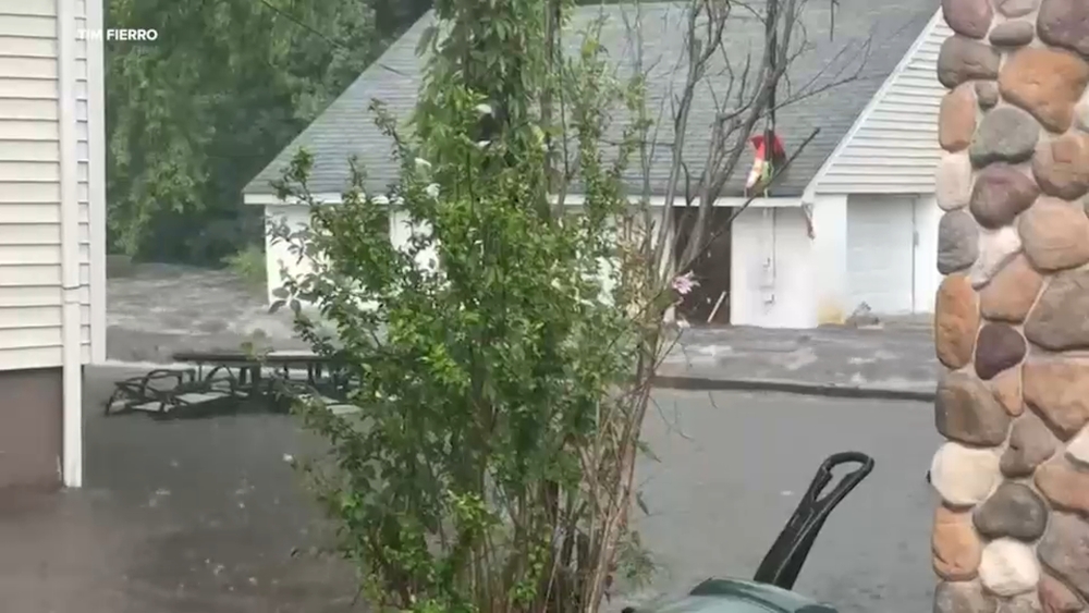
NEW YORK (WABC) -- A Flash Flood Warning has been issued for New York City and parts of the Tri-State area as storms arrive in the region.
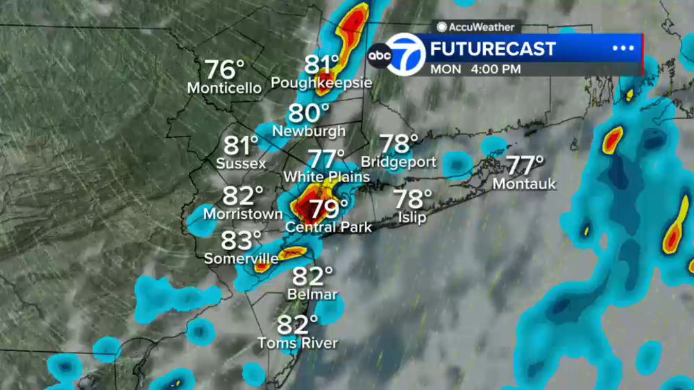
A humid and increasingly unsettled weather pattern is setting up across the region, with the potential for significant differences in rainfall totals on Monday depending on where the heaviest downpours develop. While not everyone will see excessive rain, some locations could pick up 3 to 5 inches if persistent bands of heavy rain set up overhead, while communities just a few miles away may receive only 1 to 2 inches. It will be a feast-or-famine situation when it comes to rainfall amounts.
Forecast guidance suggests that conditions will deteriorate after midnight, with heavier downpours moving into New York City's five boroughs and potentially setting up along or just northwest of the Interstate 95 corridor during the early morning hours. The exact placement of these heavier rain bands will be critical.
By Monday afternoon, areas north and west of the city may continue to see the heaviest rainfall and the greatest threat for flooding if the bands remain stationary. A final round of thunderstorms is possible into the late afternoon and early evening before activity gradually shifts offshore Monday night. Drier air is then expected to arrive on Tuesday.
Tuesday looks to be the standout day of the week, featuring more sunshine, lower humidity and temperatures in the lower 80s.
The extended forecast: Humidity and scattered showers return Wednesday, although it is not expected to be an all-day washout, with highs around 83 degrees. The remainder of the week and next weekend looks typical for the dog days of summer, with highs in the middle to upper 80s and the daily possibility of an afternoon thunderstorm, but no widespread washout days expected.
LATEST ACCUWEATHER FORECAST
THE 7-DAY FORECAST
Monday
AccuWeather Alert: Steamy and stormy. High 81
Tuesday
Some sun, less humid. High 84
Wednesday
Humid and showery. High 83
Thursday
Very humid with a storm. High 88
Friday
Steamy, PM storm. High 89
Saturday
Humid with a storm. High 86
Sunday
Familiar forecast. High 86

Follow the Weather or Not podcast with Lee Goldberg
Please fill out the form below to submit weather photos and videos.
MORE ACCUWEATHER RESOURCES
Check AccuTrack Radar
Air Quality Tracker
NWS Advisories, Watches and Warnings
School closings and delays
For weather updates wherever you go, please download the AccuWeather app.
Follow chief meteorologist Lee Goldberg, Sam Champion, meteorologist Brittany Bell, meteorologist Jeff Smith, and meteorologist Dani Beckstrom on social media.