Feb 23, 2026, 10:50 AM GMT
Snowing faster than plows can keep up
Stay with Eyewitness News for live updates on the storm. Check back here for frequent updates.


NEW YORK (WABC) -- The blizzard of 2026 impacted millions across New York City and the Tri-State area on February 22-23, 2026.
The major storm that blanketed the region with snow, canceled flights, disrupted transit and downed power lines.
More than 30 inches of snow fell on parts of Long Island and New Jersey.
What follows is our blog from coverage of the storm.
This blog is no longer being updated.
Please fill out the form below to submit weather photos and videos.
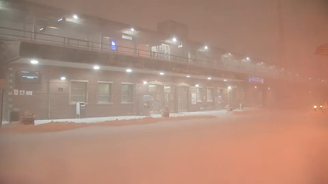
Long Island woke up to dangerous blizzard conditions this morning, with rapidly intensifying wind and snow turning communities into near-whiteout zones.
Eyewitness News reporter Phil Taitt was live in Rockville Centre, where wind gusts approaching 50 mph were whipping snow in every direction, cutting visibility to just a few feet
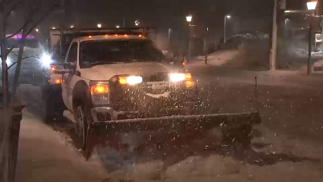
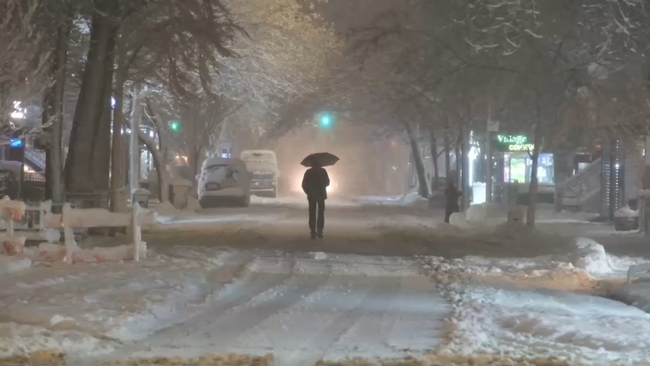
The snow hasn't let up in Lower Manhattan, and city crews have been working nonstop to keep pace. Plows have been coming through every 30 to 40 minutes, but the constant snowfall is quickly covering the roads again. With a travel ban in place until 12 p.m., the streets have stayed mostly empty - a good thing, given the blowing snow and low visibility.
Despite the quiet roads, some New Yorkers have ventured out on foot, walking dogs or checking out the accumulating snow. Power outages have hit parts of the city, with more than 6,700 customers affected in the Rockaways and nearly 10,000 citywide. In Central Park, families made the most of the early snow by building snowmen before conditions worsened.
The Department of Sanitation is in full storm mode, running 12hour shifts with more than 2,600 workers per shift. The city is also in an enhanced Code Blue, meaning no one seeking shelter will be turned away and warming centers are available through 311.
Snow is accumulating fast across the region with the peak of the storm hitting overnight.
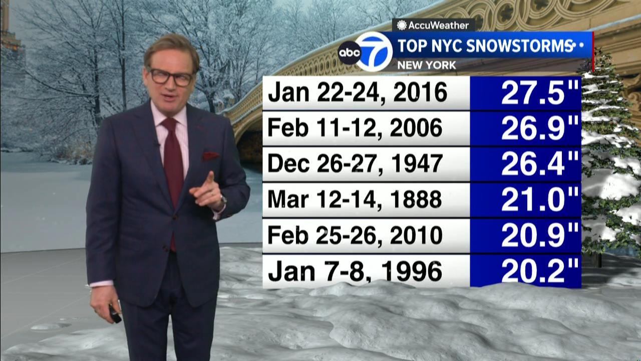
Could this storm prove to be one for the record books?
Check out the top five snowstorms in Central Park as measured by accumulation. This storm has a fighting chance of cracking this elite list.