Jan 25, 2026, 6:07 PM GMT
Send us your snow photos
We want to see your photos of the snow storm!
Share your weather photos and videos, and Eyewitness News may show them on TV or any of our digital and social platforms
The storm left well over a foot of snow in parts of the area, and cold air will be locked in place into early February.


NEW YORK (WABC) -- The winter storm of January 2026 that once covered 2,000 miles across the nation has pulled away, leaving New York City and the Tri-State area to dig out from the biggest snowfall in years.
The big dig coincided with the start of the work week, with motorists faced with treacherous drives and commuters on public transit that contended with challenges, too, though subway service was largely normal.
The storm left almost a foot and half of snow in parts of the region, while Central Park came in at 11.4 inches, a record for the day. These were not the final numbers and could go up.
There were a few more scattered snow showers early Monday but the bulk of the storm has headed out to sea. Monday's notable weather feature was the bone-chilling cold, and it will linger through at least the next seven days. Temperatures are not expected to top the freezing mark until Feb. 3, when a high of 33 is expected, still well below normal.
That means the snow and ice will stick around at least into early February.
Click here for the latest advisories, watches and warnings from the National Weather Service
We want to see your photos of the snow storm!
Share your weather photos and videos, and Eyewitness News may show them on TV or any of our digital and social platforms
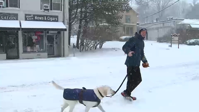
Darla Miles has more on the Mount Kisco residents venturing out in the snow on Sunday morning:
To see how recently any street has been plowed across New York City, visit PlowNYC.
Superintendent León announced Sunday that all Newark Public Schools and the Central Office will be closed on Monday, January 26th.