AccuWeather Alert: Smoky skies, drier heat
AccuWeather forecast for NYC, New York, New Jersey and Connecticut


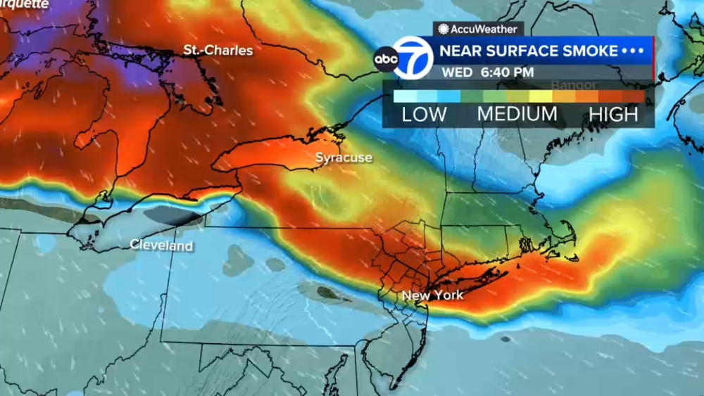
NEW YORK (WABC) -- Relief from the worst of the heat is on the way, but not before another round of smoky skies and poor air quality impacts the area.
While temperatures will remain warm through the end of the week, lower humidity levels are expected to make conditions more comfortable. Wildfire smoke will continue to move through the region into Friday morning before healthier air gradually arrives from the north. There may be brief periods of improvement, but the region remains directly in the path of the smoke plume. Conditions could actually worsen Thursday night before cleaner air begins filtering in during the day Friday.
For Thursday, the primary concern remains air quality rather than heat. Thursday's high is expected to reach 89 degrees with smoky haze, poor air quality, and breezy conditions. Boaters can expect west-southwest winds and waves of two to three feet, while beachgoers should be aware of a moderate rip current risk. Water temperatures remain in the 70s. Air quality is forecast to be unhealthy for all groups, with a medium pollen count and a UV index of six. Thursday night will remain warm, with a low near 73 degrees and continued hazy conditions.
Friday will start warm and hazy, with temperatures in the 60s and low 70s early in the day before rising into the mid to upper 80s. Despite lingering morning haze, conditions are expected to improve significantly during the afternoon, especially northward from New York City. Some southern suburbs may continue to experience poorer air quality longer into the day. Overall, Friday is shaping up to be a pleasant day with lower humidity and gradually improving skies.
Saturday brings off-and-on showers and thunderstorms, with some locations potentially seeing several rounds of rainfall. Conditions become less active on Sunday, with the best chance of a shower occurring in the morning before clouds gradually break. Forecasters believe the latter part of Sunday could be the most pleasant stretch of the weekend, which is good news for those planning to watch the World Cup final.
Monday looks partly sunny and relatively quiet between weather systems. Attention then turns to Tuesday, when showers and thunderstorms could become heavy as moisture from a developing tropical system in the Gulf potentially moves northward. While the system is not expected to become particularly strong, it could deliver periods of soaking rain and downpours.
Beyond that, conditions are expected to improve once again, with beautiful weather returning by Wednesday.
LATEST ACCUWEATHER FORECAST

THE 7-DAY FORECAST
Thursday
AccuWeather Alert: Smoky skies, drier heat. High 89
Friday
Am haze, dry heat. High 89
Saturday
Off-and-on showers, storms. High 80
Sunday
Less active. High 86
Monday
Partly sunny. High 82
Tuesday
Showers and storms. High 84
Wednesday
Back to beautiful. High 98

Follow the Weather or Not podcast with Lee Goldberg
Please fill out the form below to submit weather photos and videos.
MORE ACCUWEATHER RESOURCES
Check AccuTrack Radar
Air Quality Tracker
NWS Advisories, Watches and Warnings
School closings and delays
For weather updates wherever you go, please download the AccuWeather app.
Follow chief meteorologist Lee Goldberg, Sam Champion, meteorologist Brittany Bell, meteorologist Jeff Smith, and meteorologist Dani Beckstrom on social media.