2 hours and 9 minutes ago
VIDEO: Receding flood waters expose bucking road in Hawthorne, NJ
Video shows heavy flooding and then the aftermath of the buckling road once the waters receded on Wagaraw Road in Hawthorne, New Jersey on Tuesday night.


NEW YORK (WABC) -- Heavy rain and dangerous flash flooding remain the biggest concern overnight and into Wednesday morning as slow-moving storm system pushes across the Tri-State area.
There were multiple lows developing south of the city Tuesday night. How much rain, and how long it will last over the city depends on if the low cuts right up the coast or over central Long Island.
If it comes up the coast, that would prolong some of the heavy rain into New York City into 4 or 5 a.m. before it pushes north and east, and would maintain the heavy rain longer into morning hours over the Hudson Valley.
More likely is that the heavy rain will last until at least 3 a.m. in the city before focusing more north and east of the city, but it could still make for a rough morning commute.
Some parts of the Tri-State had already seen close to 10 inches of rain, like areas of northwestern New Jersey.
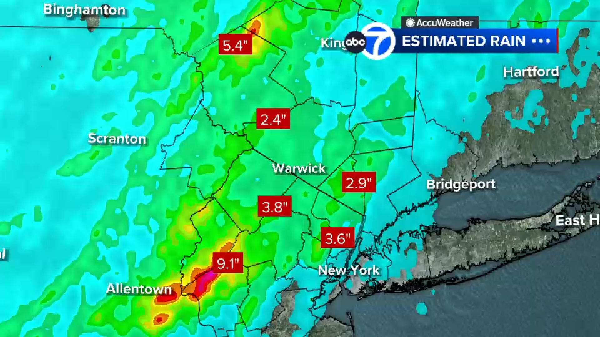
An AccuWeather Alert remains in effect Wednesday morning due to the potential for ongoing flooding problems and a few lingering showers, especially north and east of the city. Conditions should slowly improve through the day, with clouds breaking for some sunshine and only a chance of a spotty shower or thunderstorm during the afternoon. Widespread heavy rain is not expected after the morning hours.
Check here for the latest watches and warnings from the National Weather Service
Wednesday's forecast is more about dealing with the aftermath of overnight flooding than new severe weather. Travelers should allow extra time for the morning commute and remain alert for any flooded roadways.
Please fill out the form below to submit weather photos and videos.
Video shows heavy flooding and then the aftermath of the buckling road once the waters receded on Wagaraw Road in Hawthorne, New Jersey on Tuesday night.
Meteorologist Lee Goldberg forecasts that the severe weather phase of tonight's storms will begin to wind down over the next hour or so, but that doesn't mean we're out of the woods.
The brunt of the flood threat is still expected overnight until around sunrise before the storms completely move out.
New York City could see the brunt of the flood threat around 10:30/11 p.m. until around 2/3 a.m. Then storms will move east to parts of Connecticut and Long Island.
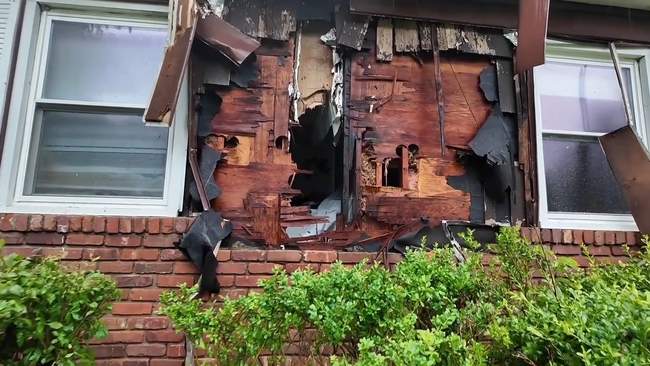
A lightning strike sparked a house fire in Wesley Hills on Tuesday afternoon amid strong storms.
Firefighters quickly opened up a wall to extinguish the fire.
There were people inside the home on Holland Lane when the lightning struck, but no one was hurt. Damage was limited.