10:11 AM GMT
Mayor Mamdani says city agencies are prepared to respond
Mayor Mamdani posted on X Monday night, saying that city agencies are ready to respond to "multiple rounds of showers and thunderstorms."

NEW YORK (WABC) -- New York City and the Tri-State Area is under an AccuWeather Alert Tuesday as two rounds of storm bring heavy rain, damaging winds, flooding and even the potential of an isolated tornado.
The first round of scattered storms developed this morning, mainly north and west of New York City, with some activity reaching closer to the city around midday. There are reports of flooding already in northern New Jersey.
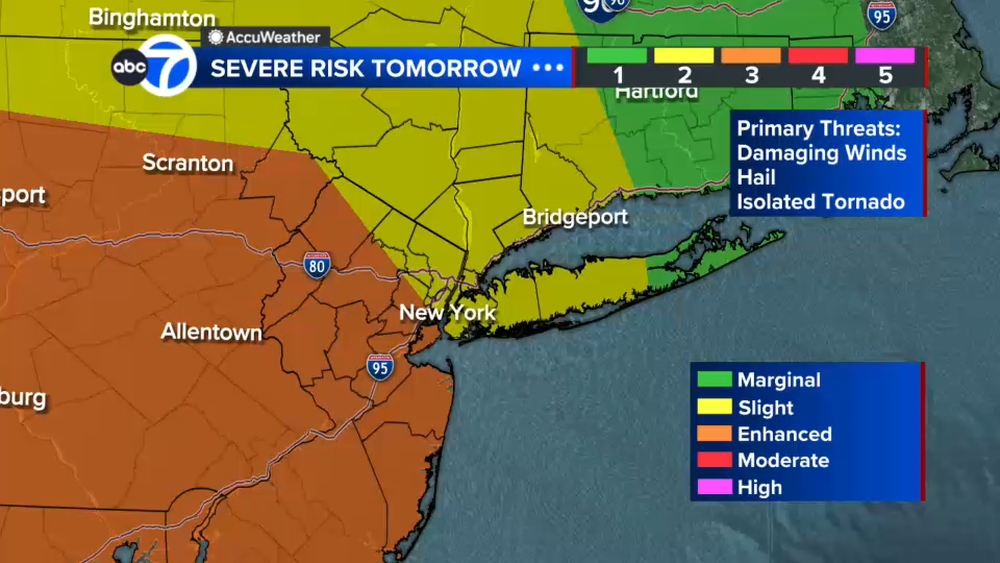
After a break in the afternoon, a second and stronger round of storms is expected between 5 p.m. and 11 p.m. Forecasters say that system could produce damaging winds, hail, flooding downpours and an isolated tornado.
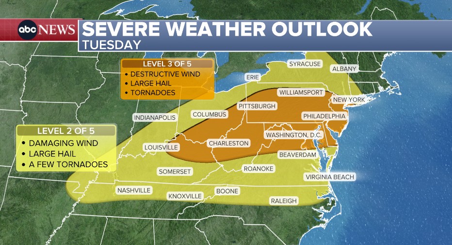
New York City and areas north and west are under a Level 2 out of 5 risk for severe weather, while most of New Jersey is under a Level 3 out of 5 risk.
A Flood Watch is in effect for most of New Jersey and New York City. Forecasters say 1 to 2 inches of rain are possible, with isolated higher totals that could lead to scattered flash flooding.
Stay with ABC 7 and Eyewitness News for the latest updates.
Mayor Mamdani posted on X Monday night, saying that city agencies are ready to respond to "multiple rounds of showers and thunderstorms."
Severe weather slammed the Midwest on Monday afternoon and night - there were at least 7 reported tornadoes across Iowa and Wisconsin.
There were also more than 90 reports of damaging winds: gusts reached 80 mph in Iowa and there was also an injury reported in Nora Springs, IA where multiple vehicles and tractor trailers were blown over.
Now that line of storms is moving through the Ohio Valley and eventually into the Northeast today.

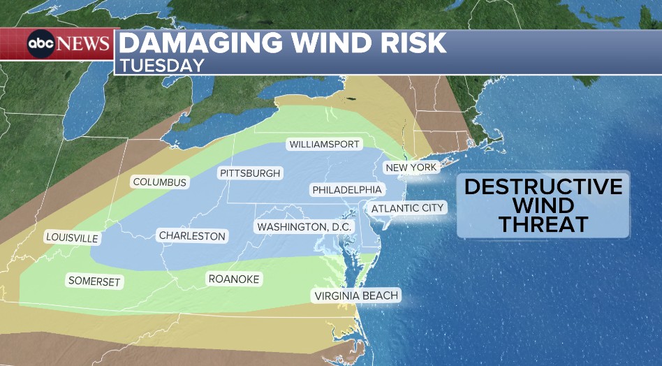
The Tri-State Area is under an AccuWeather Alert Tuesday for the threat of strong thunderstorms, damaging winds and flooding downpours, with the most significant weather expected during the evening commute.
Brittany Bell says the region will see two rounds of storms, with the stronger round expected between 5 p.m. and 11 p.m. That second wave could bring damaging wind gusts, hail, flooding and even an isolated tornado.
A Flood Watch is in effect for most of New Jersey and New York City, with a Level 2 out of 4 risk for flooding. Scattered flash flooding is considered likely, with 1 to 2 inches of rain possible and isolated locations seeing higher amounts.
Outside of thunderstorms, skies will remain mostly cloudy and humidity levels will stay high. The afternoon high temperature is expected to reach 78 degrees.

New York City is bracing for another round of heavy rain after weekend flooding submerged parts of Queens, trapped residents in their homes and stranded drivers on major roadways.
In Woodside, FDNY crews waded through waist-high water to rescue a family of four trapped in a flooded basement, while floodwaters covered portions of the BQE and Queens Boulevard.
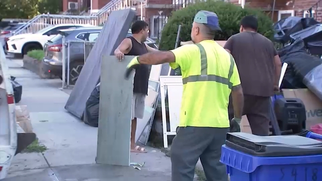
Residents in Flushing are still cleaning up sewage backups and water damage as city crews clear storm drains and prepare low-lying neighborhoods for the threat of more rain.