Severe storms trigger flash flooding, possible tornadoes across Tri-State | Live updates

WABC logo
Last updated: Wednesday, July 22, 2026 2:50PM GMT
ABC7 New York 24/7 Eyewitness News Stream
Stream New York's #1 news - AccuWeather - original content 24/7

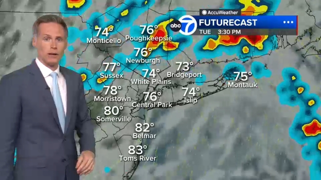
NEW YORK (WABC) -- Rounds of severe storms triggered downpours, flash flooding, damaging winds and possible tornadoes on Tuesday, just days after storms walloped New York City and the Tri-State area over the weekend.

The second dose of dangerous storms led to tornado warnings and watches being issued by the National Weather Service, which have since expired as the severe weather conditions move offshore.

RELATED | Watches, warnings and advisories from the National Weather Service

Parts of New Jersey were particularly hard-hit by Tuesday's storms, including Stanhope, where a possible tornado was spotted.

A video posted on social media also showed a funnel cloud on the ground at a golf center in Parsippany, about one mile north of the Troy Hills area.

NWS will survey those two locations on Wednesday for possible tornadoes.

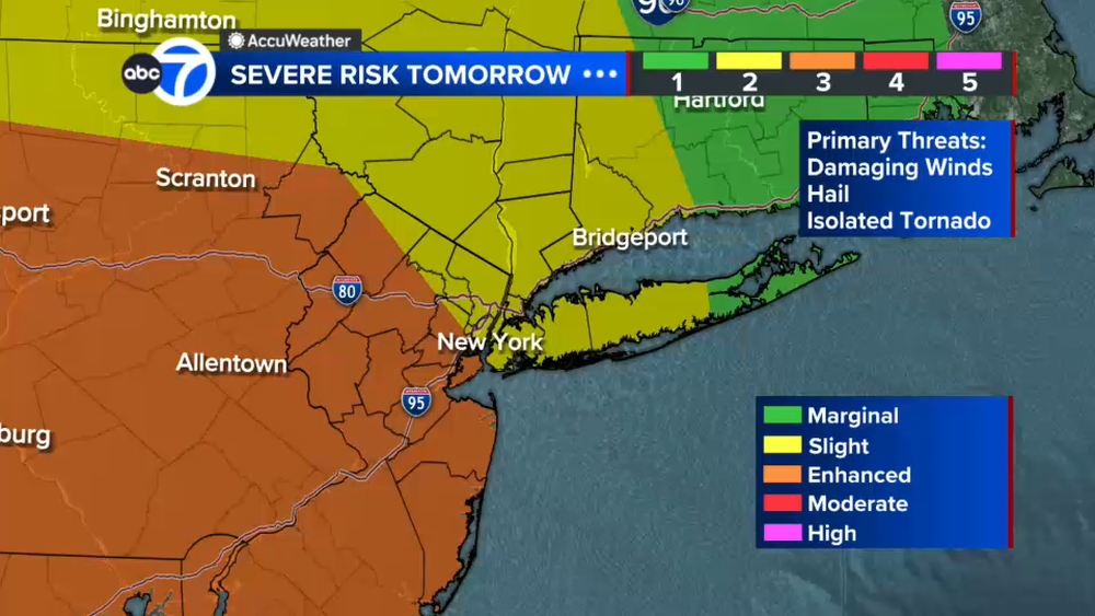
And while some afternoon storms on Wednesday won't be as severe, the NWS has put New York City and much of the Tri-State area at a marginal risk (1 out of 5) for for severe thunderstorms with the primary threat being damaging winds.

Stay with ABC 7 and Eyewitness News for the latest updates.

Key Headlines

Here's how the news is developing.
Jul 21, 2026, 5:40 PM GMT

Flooding reported in White Plains, some major roads impacted in Westchester

Reports of serious flooding are coming in from Westchester County.

The ramp from the northbound Thruway (I-87) to the Saw Mill River Parkway at exit 7A is temporarily closed due to flooding.

In White Plains, a public safety alert has gone out:

"Flooding Advisory - Please Use Caution

Heavy rainfall has resulted in flooding in several areas throughout the City.

Do not drive through flooded roadways. Even shallow water can hide hazards or cause your vehicle to stall. Turn around and find an alternate route whenever possible.

We are also receiving numerous reports of missing or loose manhole covers that have been displaced by flooding. These openings may be concealed beneath standing water and present a serious danger to both motorists and pedestrians.

If you observe an open or displaced manhole, please report it immediately to the White Plains Police Department at (914) 422-6111.

Please slow down, remain alert, and allow extra travel time as crews respond to weather-related hazards."
Jul 21, 2026, 5:27 PM GMT

Norwalk, New Canaan police urge drivers to avoid flooded areas

Norwalk, Connecticut, police are receiving numerous reports of flooding throughout the city. They urge drivers not to drive through standing or moving water.

"Just a few inches of water can cause you to lose control of your vehicle, and deeper water can quickly sweep a vehicle away or hide dangerous road hazards. Turn Around, Don't Drown. Take an alternate route and avoid flooded streets," police said on an X post.

Similar reports and warnings are coming police in New Canaan.

Much of Fairfield County is under a Flash Flood Warning until 3:30 p.m.

Jul 21, 2026, 5:04 PM GMT

Flash Flood Warning in Westchester and Fairfield counties until 3:30 p.m.

Jul 21, 2026, 5:47 PM GMT

Jeff Smith on flooding trouble spots in New Jersey

Jeff Smith reports on several flooding hot spots in northern New Jersey.