Severe storms trigger flash flooding, possible tornadoes across Tri-State | Live updates

WABC logo
Last updated: Wednesday, July 22, 2026 3:07AM GMT
ABC7 New York 24/7 Eyewitness News Stream

NEW YORK (WABC) -- Rounds of severe storms triggered downpours, flash flooding, damaging winds and possible tornadoes on Tuesday, just days after storms walloped New York City and the Tri-State area over the weekend.

The second dose of dangerous storms led to tornado warnings and watches being issued by the National Weather Service, which have since expired as the severe weather conditions move offshore.

RELATED | Watches, warnings and advisories from the National Weather Service

Parts of New Jersey were particularly hard-hit by Tuesday's storms, including Stanhope, where a possible tornado was spotted.

A video posted on social media also showed a funnel cloud on the ground at a golf center in Parsippany, about one mile north of the Troy Hills area.

NWS will survey those two locations on Wednesday for possible tornadoes.

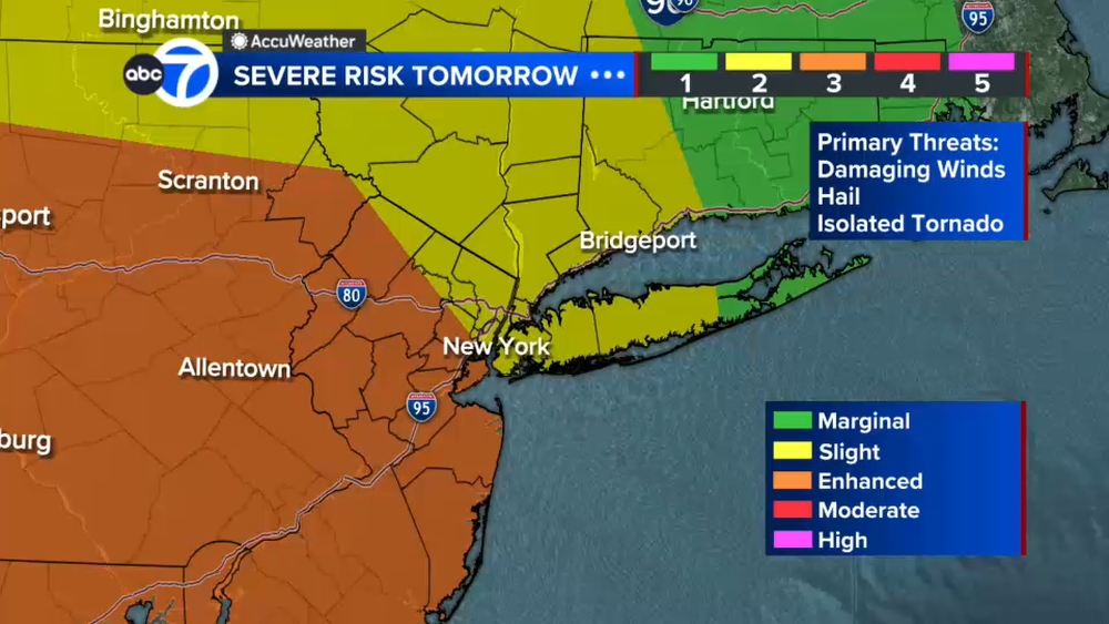
And while some afternoon storms on Wednesday won't be as severe, the NWS has put New York City and much of the Tri-State area at a marginal risk (1 out of 5) for for severe thunderstorms with the primary threat being damaging winds.

Stay with ABC 7 and Eyewitness News for the latest updates.

Key Headlines

Here's how the news is developing.
Crystal Cranmore Image
Jul 21, 2026, 8:56 PM GMT

Woodside Queens bracing once again for potentially more flooding

The community of Woodside, Queens, is bracing once again for potentially more flooding.

"We're getting sandbags and we're going to fill them and put them at every entrance. That's the only thing I can think of," Michael Hillock of Maran's Auto Body shop said.

Hillock said the shop lost thousands of dollars worth of items after Saturday's downpour.
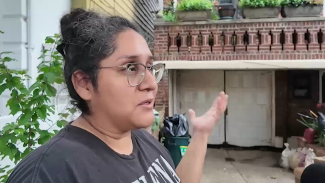
Crystal Cranmore reports from Queens with more on how residents are preparing for another round of potential flash flooding.

"The furnace we've replaced the furnace here like three times in five years. That's the first thing that goes. We have a compressor downstairs, like a backup one that was the water was up to the ceiling in the basement downstairs. That was floating. It's just a huge mess," Hillock.

Piles of garbage are still surrounding roads.

Just days ago drivers found themselves stranded on cars. The Fire Department had to rescue residents from their homes.

For now, community members are hoping for the best but planning for the worst.

"More rain. Biggest concern at this point. More rain, more like car damages. Um, my things are getting wet again, so we're just trying to lift everything up as soon as possible because we can't do much," Sharon Naupari said.
Jul 21, 2026, 9:47 PM GMT

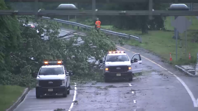
A trained tornado spotter witnessed a tornado touch down in Stanhope

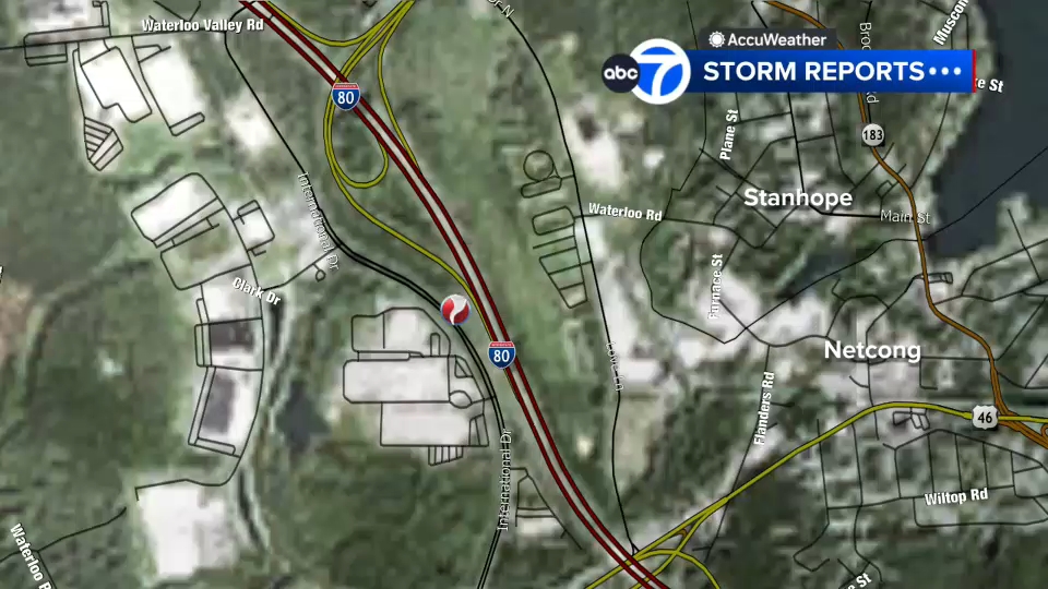
Stanhope Police sad they have not confirmed a report by a trained tornado spotter who witnessed a tornado touching down at the intersection of I-80 and Route 206 in Stanhope.

Toni Yates has the details on the possible tornado in Stanhope, New Jersey.

There are reports of trees and debris on the road.

Jul 21, 2026, 7:00 PM GMT

Tornado Warning for Bergen, Passaic, Essex, Somerset and Morris counties in New Jersey

Tornado Warnings have been issued for Bergen, Passaic, Essex, Somerset and Morris in New Jersey. Cities include Fair Lawn, Paterson and Wayne.

Jul 21, 2026, 6:28 PM GMT

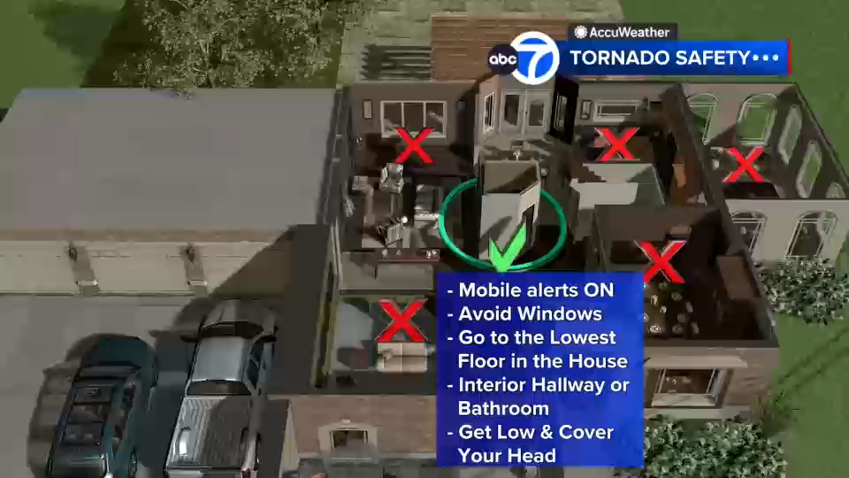
Precautions to take and safety tips during tornado threats

There are some precautions you can take during tornado threats.

Avoid windows, go to the lowest level of your home or an interior bathroom or hallway.

Also, stay low and cover your head.