Winter storm pulls away after dumping heavy snow; frigid air won't budge | Live updates

The storm left well over a foot of snow in parts of the area, and cold air will be locked in place into early February.

WABC logo
Last updated: Tuesday, January 27, 2026 4:38PM GMT
ABC7 New York 24/7 Eyewitness News Stream

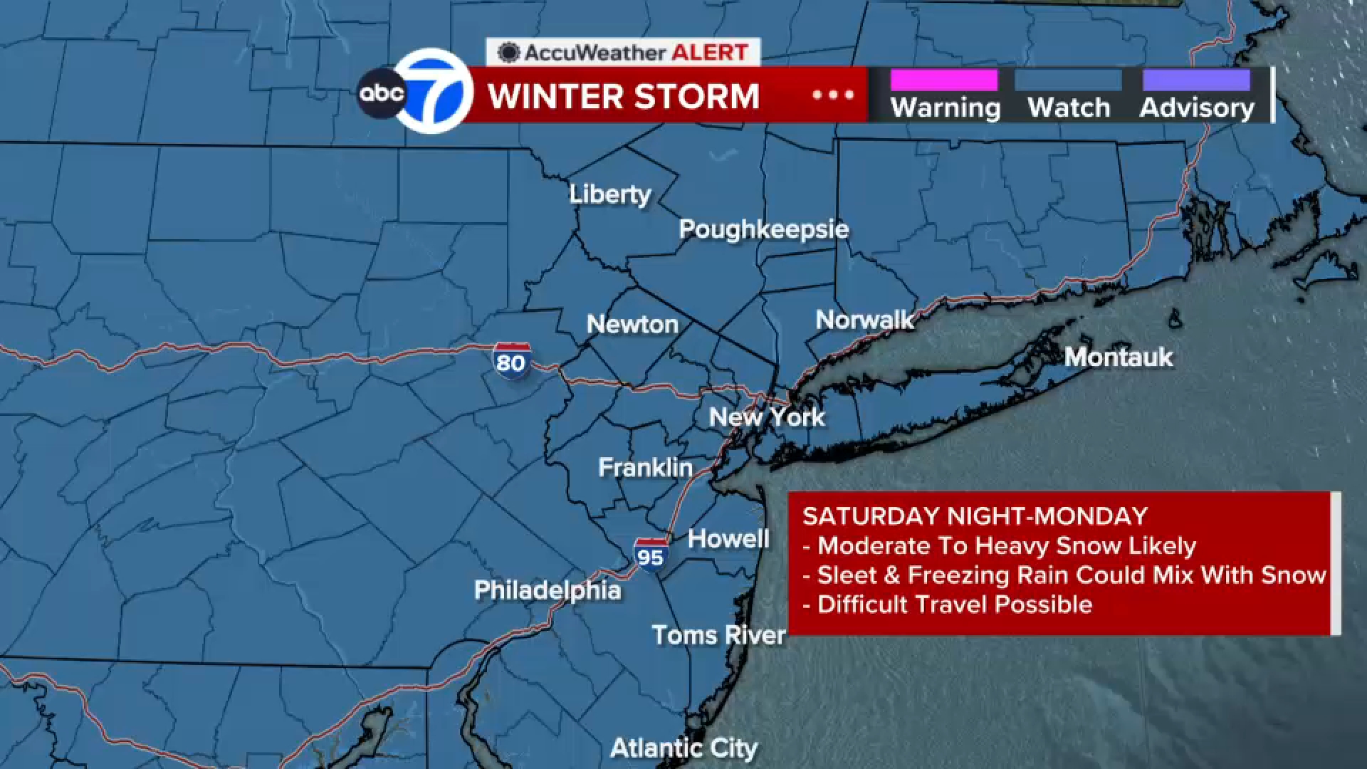
NEW YORK (WABC) -- The winter storm of January 2026 that once covered 2,000 miles across the nation has pulled away, leaving New York City and the Tri-State area to dig out from the biggest snowfall in years.

The big dig coincided with the start of the work week, with motorists faced with treacherous drives and commuters on public transit that contended with challenges, too, though subway service was largely normal.

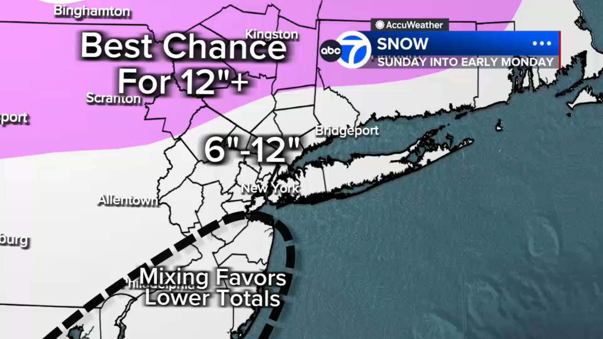
The storm left almost a foot and half of snow in parts of the region, while Central Park came in at 11.4 inches, a record for the day. These were not the final numbers and could go up.

There were a few more scattered snow showers early Monday but the bulk of the storm has headed out to sea. Monday's notable weather feature was the bone-chilling cold, and it will linger through at least the next seven days. Temperatures are not expected to top the freezing mark until Feb. 3, when a high of 33 is expected, still well below normal.

That means the snow and ice will stick around at least into early February.

Latest Forecast

Stay with Eyewitness News for live updates on the commute and the recovery from the storm. Check back here for frequent updates.

Click here for the latest advisories, watches and warnings from the National Weather Service


Key Headlines

Here's how the news is developing.
Jan 22, 2026, 6:27 PM GMT

Updated potential snowfall map

Eyewitness News meteorologists have an updated map of potential snowfall totals in the New York City metropolitan area.

Areas well north and west of New York City could see accumulations of a foot or more of snow, with bullseye regions including northwestern New Jersey, the Hudson Valley and eastern Pennsylvania.

The area around the city and Long island, as well as much of New Jersey, could land in the 6-to-12-inch range, but those numbers could be impacted by mixing with sleet or freezing rain, which is likely to tamp down totals the farther south you go.

WABC logo
Jan 22, 2026, 6:24 PM GMT

Brittany Bell's latest AccuWeather forecast

WABC logo
Jan 22, 2026, 6:21 PM GMT

Cold Weather Advisory in effect for the NYC area

A Cold Weather Advisory in effect for the New York City area starting Friday night as an arctic blast moves in ahead of the winter storm.

The advisory impacts New York City, and portions of southeast New York, most of New Jersey and southern Connecticut.

Click here for the latest advisories, watches and warnings from the National Weather Service

Wind chills around 10 degrees and below are expected, and in some parts, wind chills around 5 degrees and below are expected.

WABC logo
Jan 22, 2026, 6:00 PM GMT

Winter Storm Watch issued for NYC, Tri-State ahead of weekend snow storm

A Winter Storm Watch has been issued for the New York City metropolitan area ahead of this weekend's snow storm.

The watch includes New York City, all of southeast New York, northeast New Jersey, and southern Connecticut, and will be in effect Saturday night through Monday afternoon.

The storm could lead to slick and hazardous roads, especially bridges and overpasses.