ACCUWEATHER ALERT: Some snow, then frigid


NEW YORK (WABC) -- Some snow and a light mix of precipitation arrived in parts of the New York area on Tuesday afternoon ahead of much colder temperatures and gusty winds.
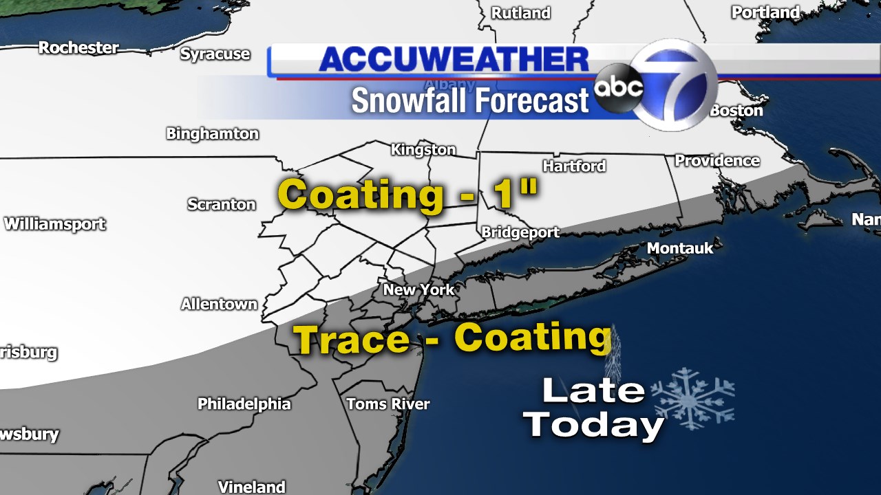
An arctic cold front will push through the area around 8:00 p.m. and could drop a coating of snow just about anywhere.
Here's a look at the expected snowfall:
Behind the front, meteorologist Lee Goldberg says the temperature drops and wind gusts kick up to 20 to 40 mph. Those blustery conditions will continue on Wednesday and the temperate will struggle to get above 30 degrees.
As the temperatures drop, black ice could form and create treacherous driving conditions, especially north and west of the city.
Check here in the morning for any school closings or delays.
Watch the latest AccuWeather forecast here:
Have weather photos you want to share with us? Use the hashtag #abc7ny on Twitter and Instagram.
Check the AccuWeather forecast and AccuTrack Radar anytime at abc7ny.com/weather.


