Hurricane Ian live radar: Latest maps, projections, possible path after South Carolina landfall
Ian strengthened back to a Category 1 storm before landfall but is now a cyclone.

GEORGETOWN, S.C. -- Hurricane Ian has made landfall again, after delivering a devastating impact to southwestern Florida and western Cuba earlier in the week.
It was downgraded to a post-tropical cyclone hours later.
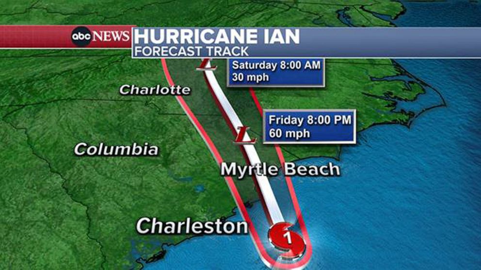
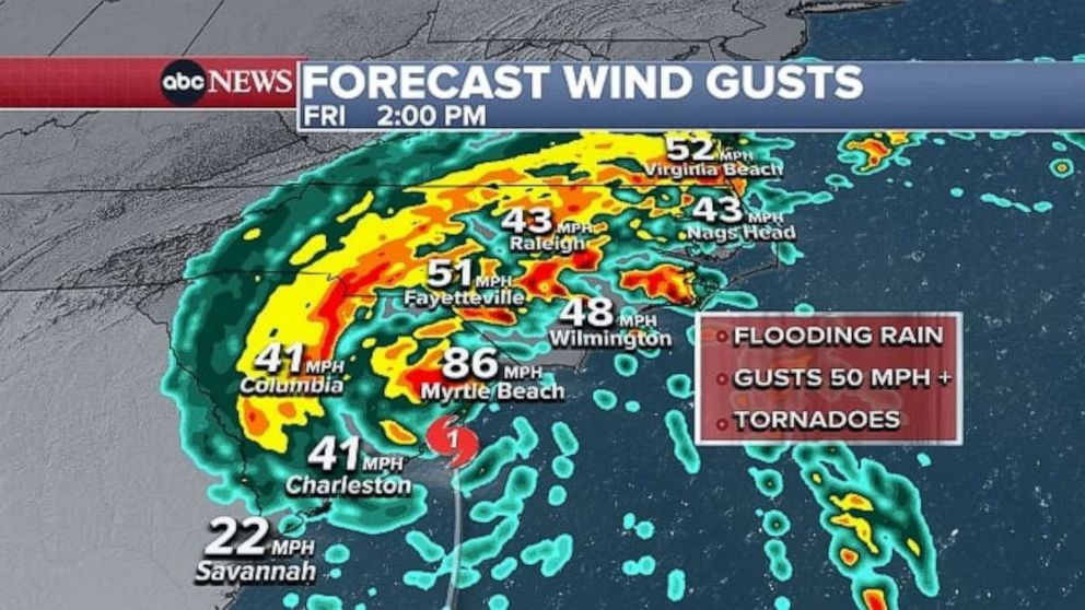
Ian made landfall as a Category 1 storm at 2:05 p.m. ET Friday near Georgetown, South Carolina, with sustained winds of 85 mph, according to the National Hurricane Center.
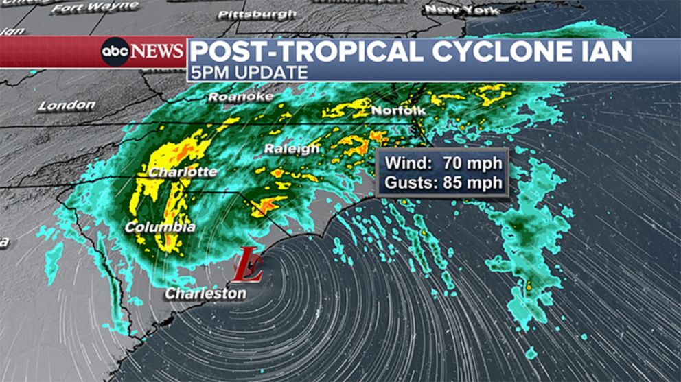
By 11 p.m. ET Friday, the winds had dropped to about 50 mph as the post-tropical cyclone continued to move north along the eastern seaboard. It was expected to continue dropping heavy rainfall on the mid-Atlantic and Northeast states through Saturday morning.
Major cities along the East Coast from Washington D.C. to New Haven, Conn., could expect to see about 3-6 inches of rain falling Saturday.
Ian first made landfall in Cuba as a Category 3 storm early Tuesday, hitting the island's western end.
After traveling through the Gulf of Mexico, it made landfall again along the southwestern coast of Florida Wednesday afternoon as a Category 4 storm, the National Hurricane Center said. Landfall was near Cayo Costa, an island off the coast of Fort Myers, with the deadly storm then traveling through central Florida.
After being downgraded to a tropical storm briefly, Ian strengthened back to a Category 1 hurricane as it traveled off the east coast of Florida and into the warm waters of the Atlantic Ocean toward the Carolinas.
Projected path and spaghetti model
Ian is expected to rapidly weaken, though will bring the threat of heavy rain and flooding to the mid-Atlantic.

Weather alerts extend across four states, from Florida to North Carolina. A hurricane warning has been issued for the entire coast of South Carolina and the southern coast of North Carolina, including Wilmington.
A hurricane watch is also in effect for parts of the North Carolina coast.
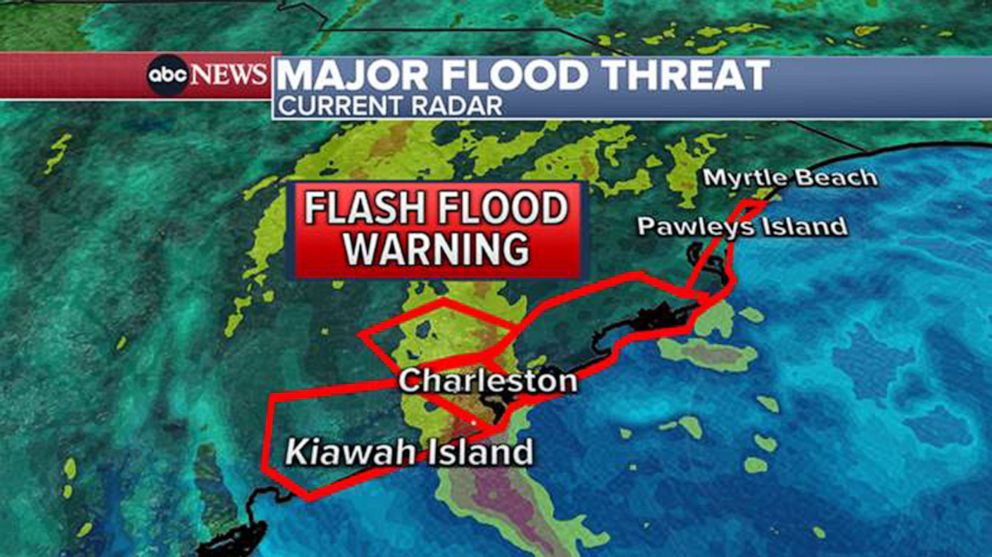
Storm surges
Southwest Florida saw catastrophic storm surge, and life-threatening storm surge remains a risk as Ian moves north. Charleston, which is in the bullseye of the storm's next landfall, could see storm surge of at least 7 feet high.
Rainfall
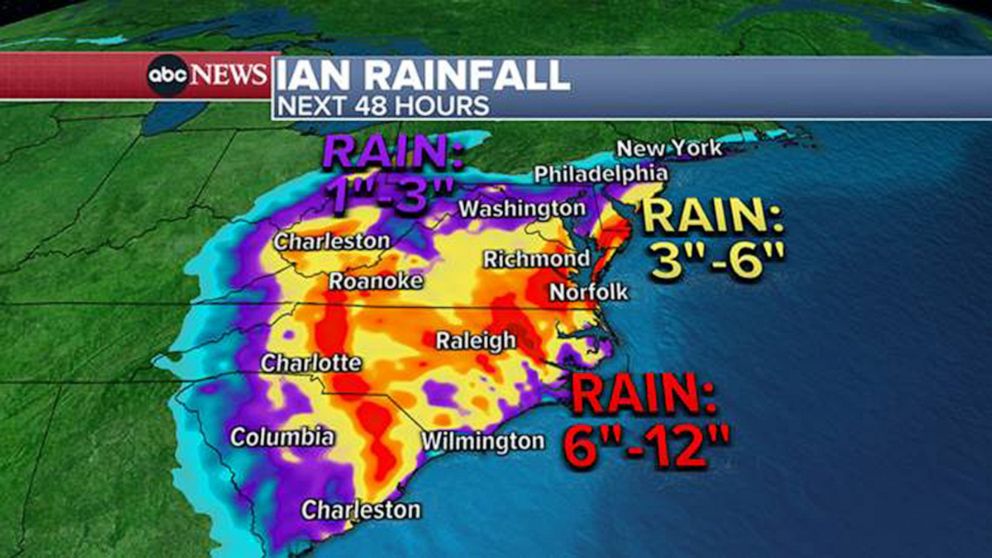
Reported rainfall has topped a foot in numerous communities in central Florida, with some seeing as much as 2 feet. Flooding remains a risk as Ian moves north, with up to 12 inches forecast from Charleston to the North Carolina border.
Up to 6 inches is also possible in parts of the Carolinas.
Some of the heavy rain will come up to Philadelphia and the New York City area by Saturday morning, with 2 to 3 inches of rain possible locally.
Tornado threat
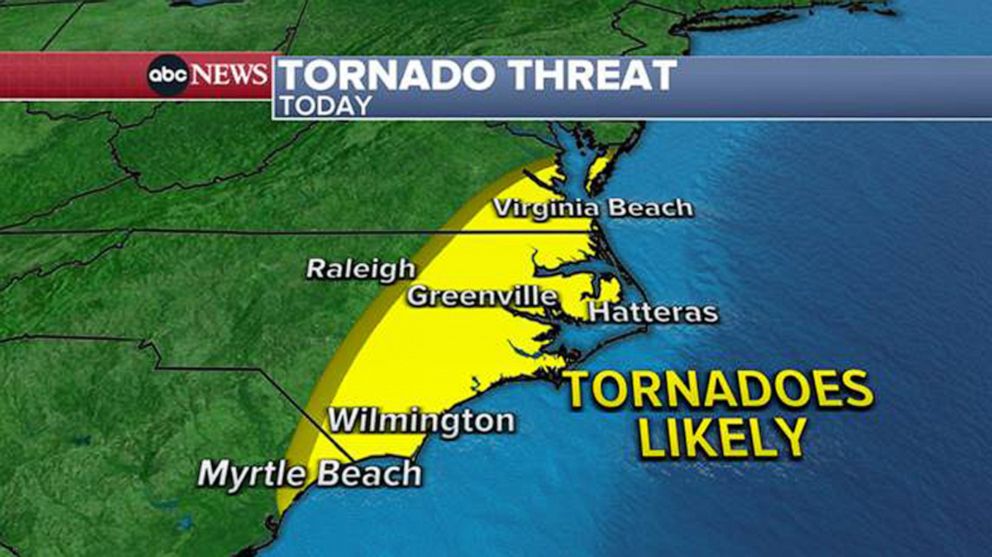
Tornadoes are also possible as Ian makes landfall. A tornado watch is in effect from Myrtle Beach, South Carolina, to Virginia Beach, Virginia, through 10 p.m. Friday.
Extreme wind
ABC Owned TV Stations contributed to this report.