Jul 28, 2026, 9:12 PM GMT

NEW YORK (WABC) -- Much of New Jersey and the Catskills are drying out Wednesday morning after heavy rain soaked the region, but flooding concerns remain for parts of the Tri-State area. Flooding downpours are expected to continue through sunrise across Long Island, the Hudson Valley and Connecticut, where an AccuWeather Alert remains in effect and a Flood Watch continues.
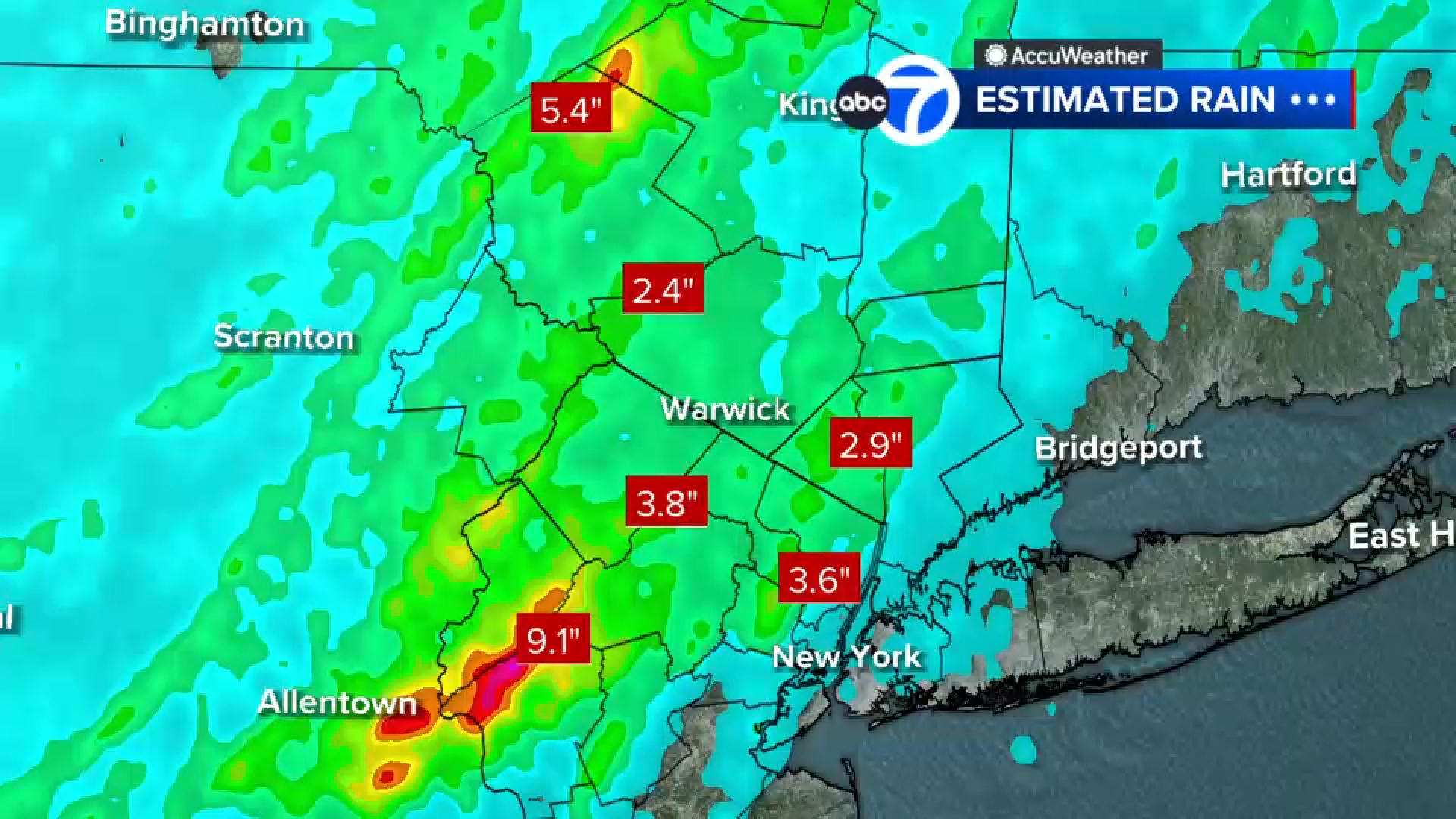
The steady rain will gradually taper to scattered showers this afternoon, with a few breaks of sunshine possible and highs reaching the upper 70s.
Looking ahead, a few showers are possible Thursday, while Friday brings more sunshine and only the chance of a stray thunderstorm.
Check here for the latest watches and warnings from the National Weather Service
The weekend looks mostly dry, with the next chance for storms arriving late Sunday. Partly cloudy skies and an isolated shower or thunderstorm are possible Monday and Tuesday.
Please fill out the form below to submit weather photos and videos.
The National Weather Service has issued a Severe Thunderstorm Warning for Staten Island, and parts of New Jersey.
The affected counties in New Jersey include Hudson, Passaic, Union, Bergen and Essex counties.
The warning lasts until 4:45 p.m.