AccuWeather Alert: Rounds of thunderstorms
AccuWeather forecast for NYC, New York, New Jersey and Connecticut


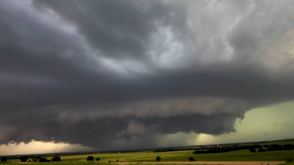
NEW YORK (WABC) -- Rounds of potentially severe thunderstorms return on Tuesday, which could have a similar impact on the Tri-State area as our most recent storms this past weekend.
We expect the first round of storms, at midday, slamming areas that were already hit hard with rain on Saturday.
There is potential for flash flooding at this time. A second round of powerful storms is possible Tuesday evening, with strong thunderstorms, hail and a possible tornado.
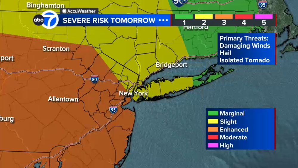
A Flood Watch was issued effective at 8 a.m. Tuesday for much of New Jersey and New York City as an "enhanced" (level 3 our of 5) risk of severe thunderstorms now covers much of New Jersey and even parts of New York City.
There is also a level 2 out of 4 risk of flash flooding, mainly off to the south of New York City and central and southern parts of New Jersey.
Click here for the latest advisories, watches and warnings from the National Weather Service
Storms will begin to subside late Tuesday night, but there could still be some pockets of showers into the overnight hours.
On Wednesday, there could still be a shower or thundershower around before we completely dry out into the day on Thursday, when sunshine returns.
Friday will be a beautiful end to the work week, and the weekend looks to be warm and mostly sunny.
LATEST ACCUWEATHER FORECAST
THE 7-DAY FORECAST
Tuesday
AccuWeather Alert: Rounds of t-storms. High 78
Wednesday
Some sun and a storm. High 83
Thursday
Back to beautiful. High 81
Friday
Another beauty. High 82
Saturday
Warm sunshine. 84
Sunday
Sun and some clouds 85
Monday
Thunder threat. High 87

Follow the Weather or Not podcast with Lee Goldberg
Please fill out the form below to submit weather photos and videos.
MORE ACCUWEATHER RESOURCES
Check AccuTrack Radar
Air Quality Tracker
NWS Advisories, Watches and Warnings
School closings and delays
For weather updates wherever you go, please download the AccuWeather app.
Follow chief meteorologist Lee Goldberg, Sam Champion, meteorologist Brittany Bell, meteorologist Jeff Smith, and meteorologist Dani Beckstrom on social media.