Dangerous winter storm to unleash floods, high winds, heavy rain | Weather or Not


NEW YORK (WABC) -- Our active weather pattern shows no signs of letting up, with a powerful winter storm that will impact much of the country poised to wreak havoc on the Tri-State area later Tuesday into Wednesday, and more systems ahead in coming days.
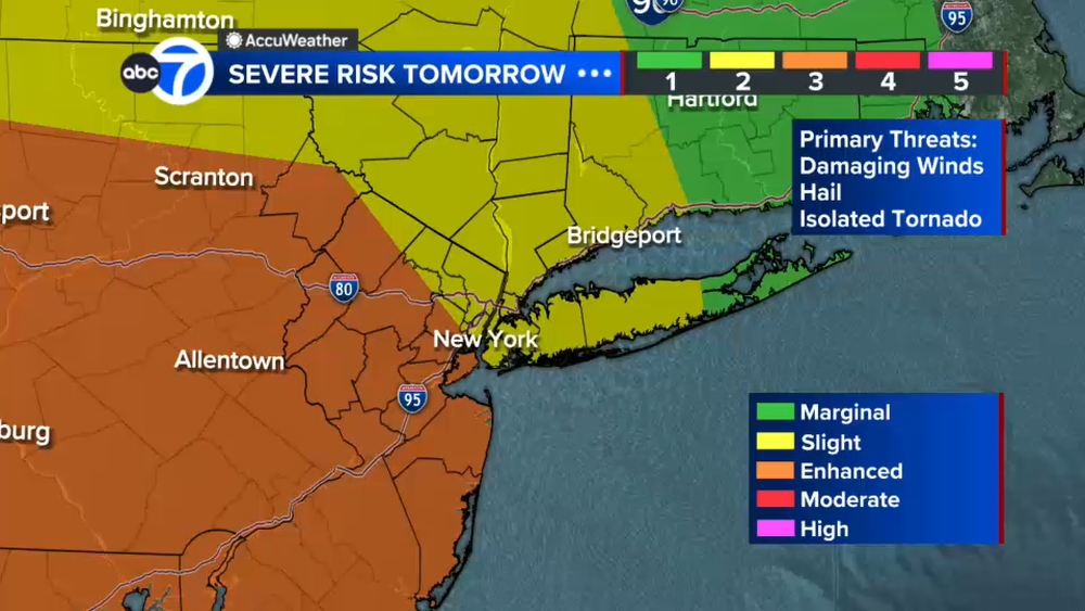
This latest storm, a type known as a Cutter, will wallop the Midwest with heavy snow. In New York area, we are facing an all-rain event, one that promises to dump between 2 to 4 inches of rain, unleash ferocious winds of up to 60 mph or even greater and set off potentially devastating flooding. The heavy rain and warmer temperatures - rising into the 50s and pushing 60 - will set off what Lee Goldberg describes as a flash melt.
Of particular concern are communities along the Passaic River in New Jersey, which are still recovering from significant flooding last month. Lee Goldberg talks to Little Falls Mayor James Belford Damiano, who explains the threat his community is facing and what the Department of Public Works is doing to protect residents.
Once this storm clears, another potent weekend storm looms. That one, too, is looking like a winter super soaker. But yet another system next week could be arrive with colder air in place, raising the prospect of snow falling on the I-95 corridor for the first time this season.
Below, hit subscribe and never miss an episode of "Weather or Not with Lee Goldberg."